In this blog post, we begin our journey home, leaving the main part of Alaska, backtracking on the Alaska Highway, and then traveling to a portion of Southeast Alaska (the panhandle).
To Alaska and Back Part 9: Leaving and Re-Entering Alaska (in Haines)!
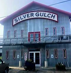
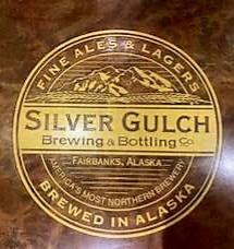
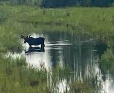
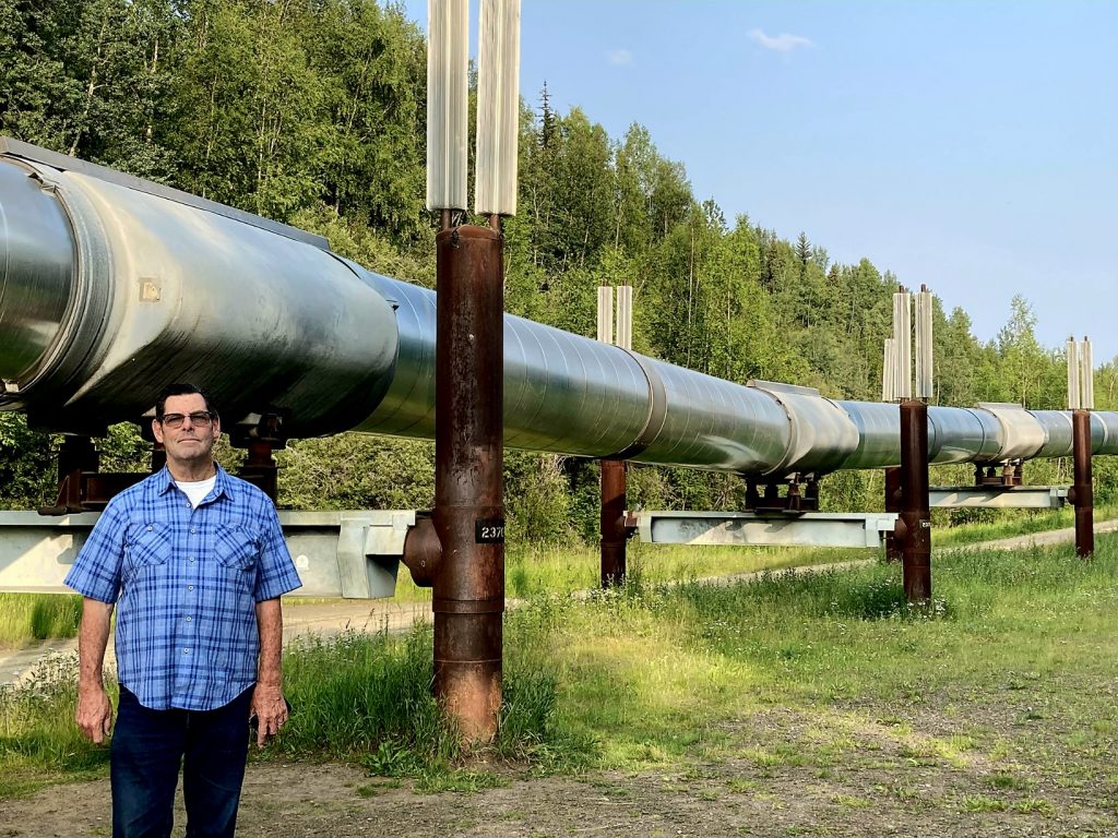
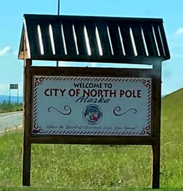
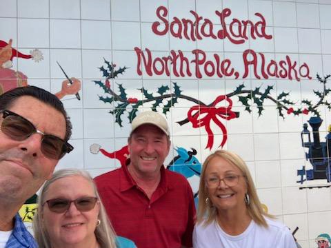
Day 56 As we departed the Fairbanks area today, we were sad that we weren’t able to do anything there because we both contracted Covid. But here are a few pictures from Judy and Allyn, who explored North Pole, visited the northernmost brewery in North America (Silver Gulch), and spotted their first bull moose of the trip.
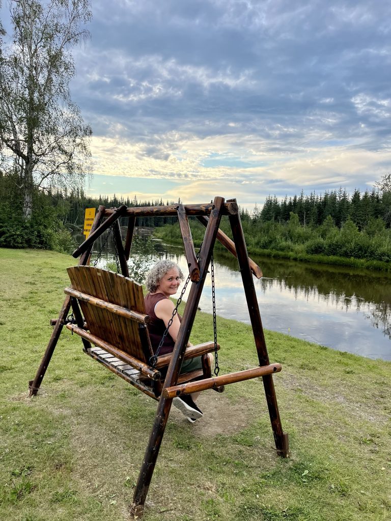
Sitting by the river in Fairbanks--self-isolating because of Covid.
Allyn's pictures at Silver Gulch, the northernmost brewery in North America
Allyn and Judy spotted this bull moose!
A close-up of the Alaska pipeline--it's massive! (Judy's photo)
Judy and Allyn's pictures at North Pole
A personal visit with Santa and Mrs. Claus!
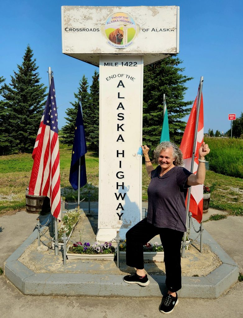
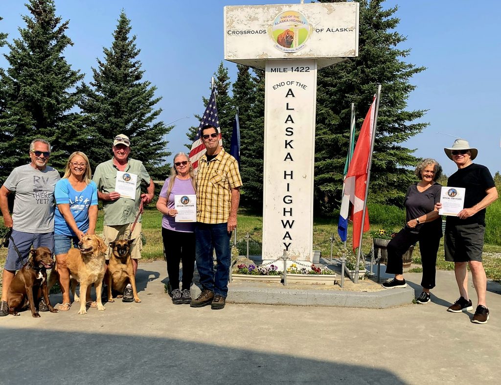
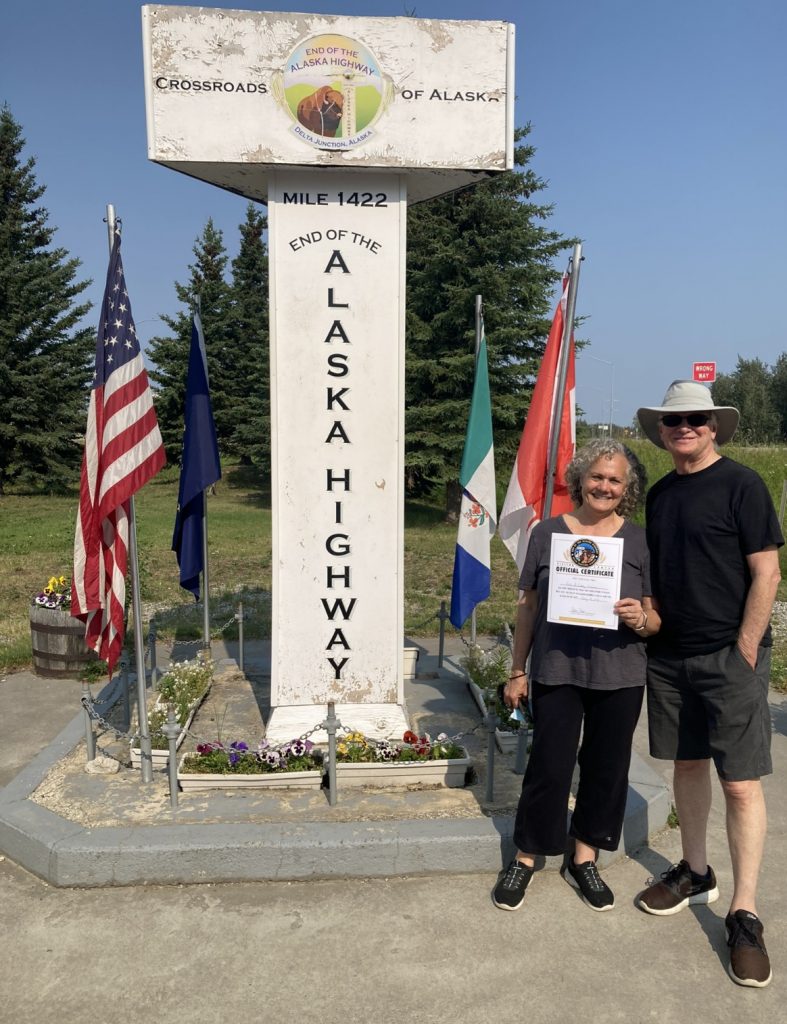
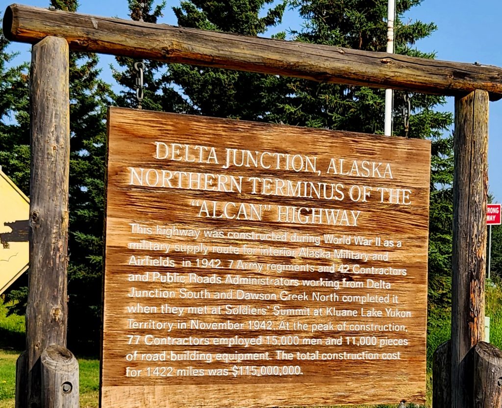
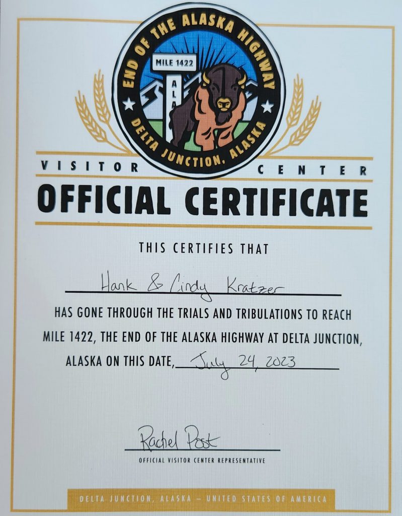
Hank and I self-isolated in our RV and were very thankful for the medication that greatly speeded our recovery. Today we drove first to Delta Junction where we officially completed the Alaska Highway (we had driven most of the highway in June but saved the very last part for now). At the Visitor Center, you can purchase your official “I Drove the Alaska Highway” certificate for $3 and pose in front of the display. We only took off our masks for a few pictures..
We did it! We drove the entire Alaska Highway!
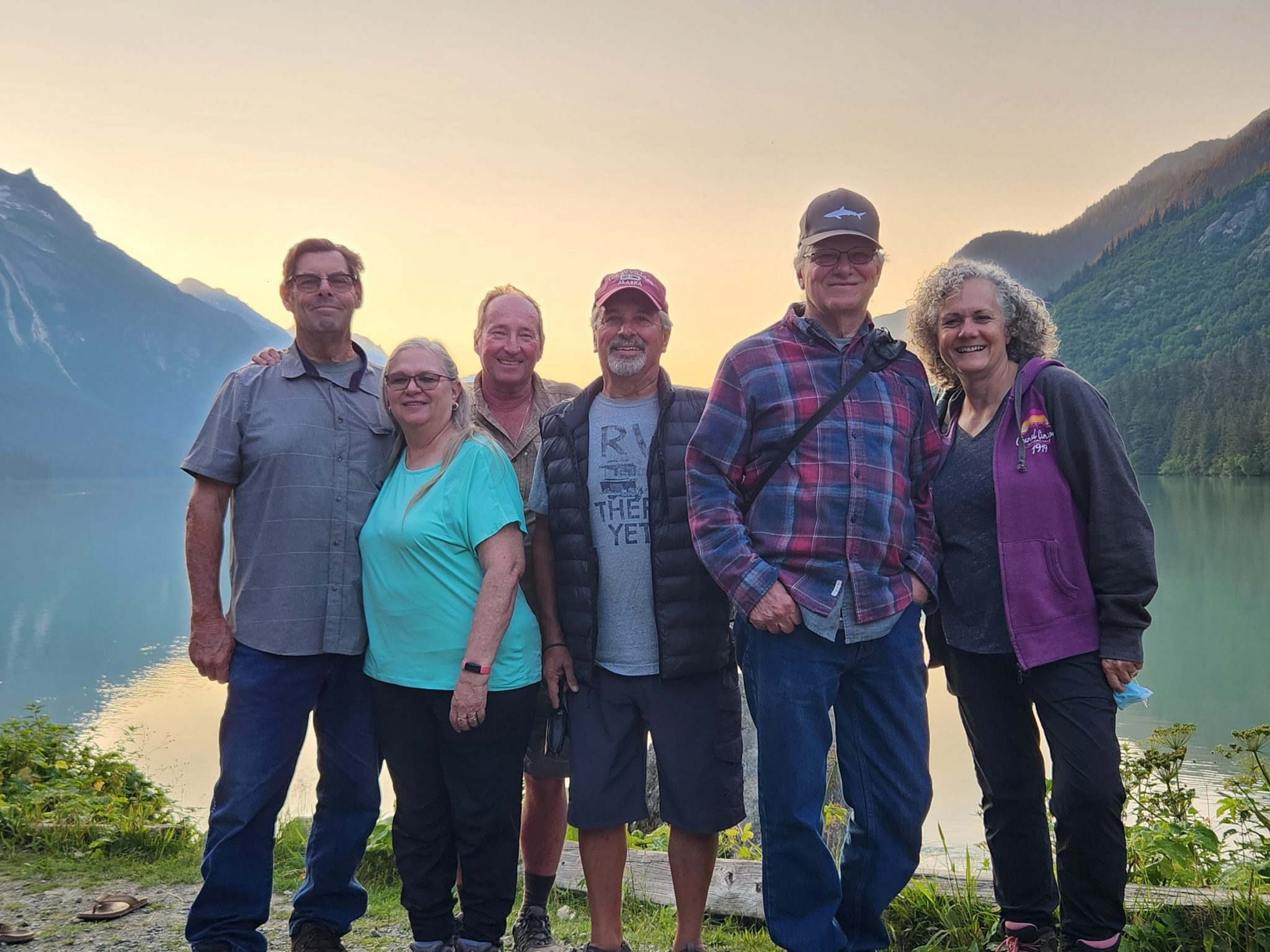
All of the Alaska 7 (plus 3 dogs and 2 cats) completed the Alaska Highway!
The official end of the Alaska Highway is in Delta Junction, Alaska, between Fairbanks and Tok (Judy's photo).
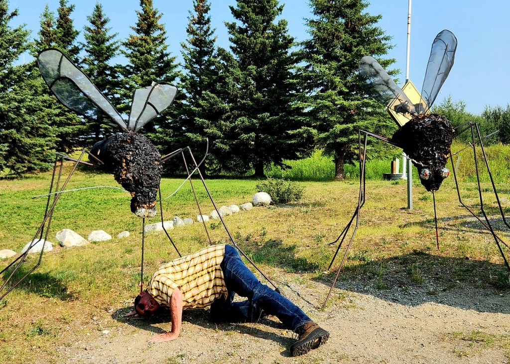
Where's Allyn? Being attacked by 2 giant mosquitoes, the unofficial state bird of Alaska.
And here's the certificate to prove we finished the Alaska Highway!
We then headed back to Tok, which was the first town we encountered when we entered Alaska five weeks ago! It was sad to think of leaving this amazing state, but we had a couple of additional stops to look forward to.
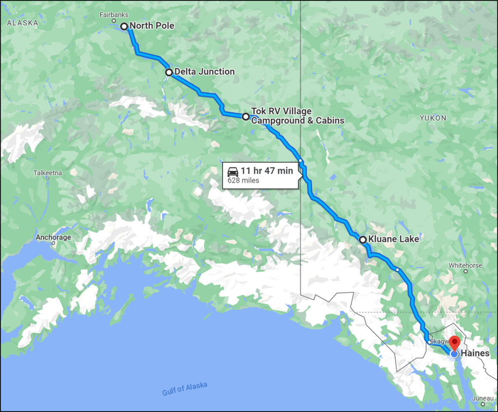
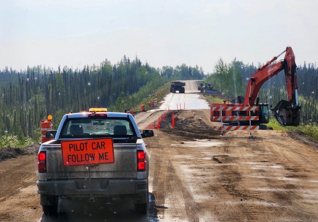
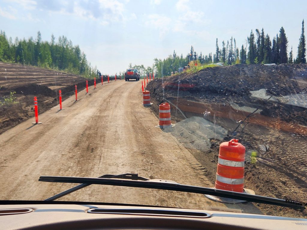
Day 57 Today’s route was our most difficult driving day on the way up, and it was still not very fun on the way back. From Tok, Alaska, to Destruction Bay, Yukon Territory, the road is full of frost heaves, potholes, and places where road work is being done. There were definitely improvements from our trip north, but it still took 7-½ hours to drive 235 miles, crossing the border back into Canada at Beaver Creek. It is a beautiful drive, though, which provides some compensation.
There are two seasons in the north: winter and road work!
Sure, we can drive our 30-foot motorhome on this patch of dirt!
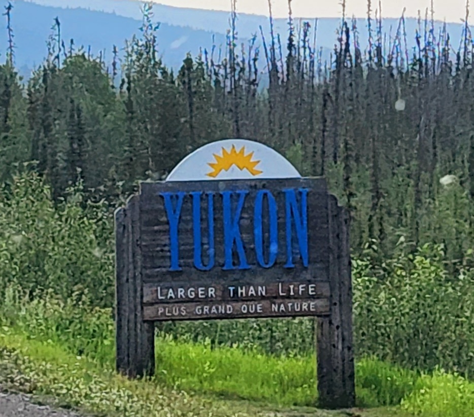
Back in Canada, back in the Yukon Territory
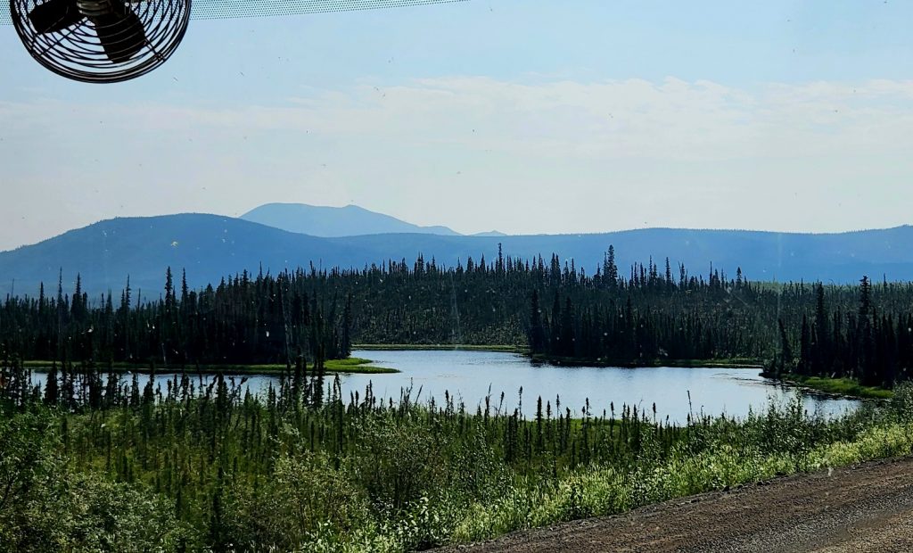
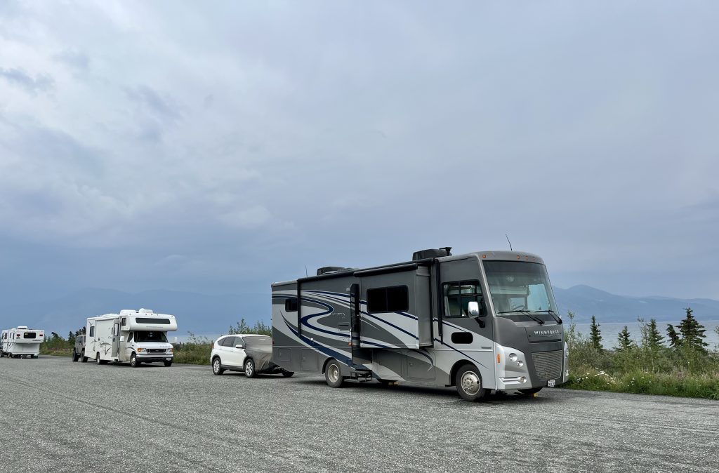
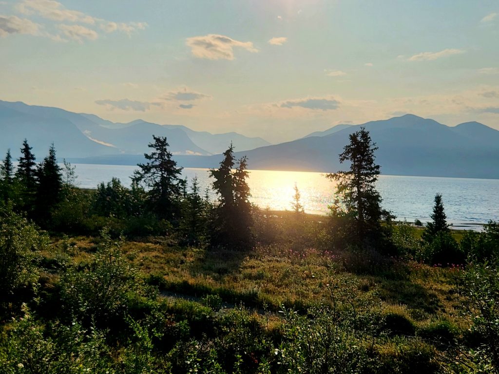
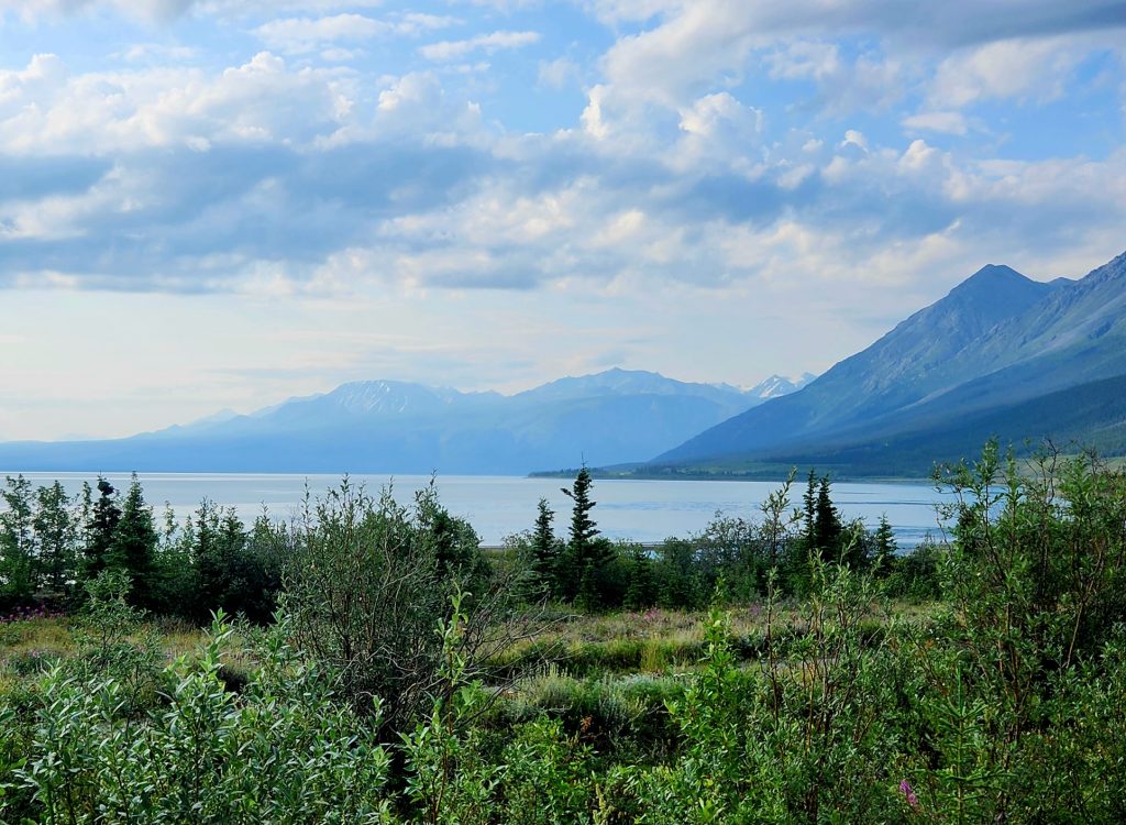
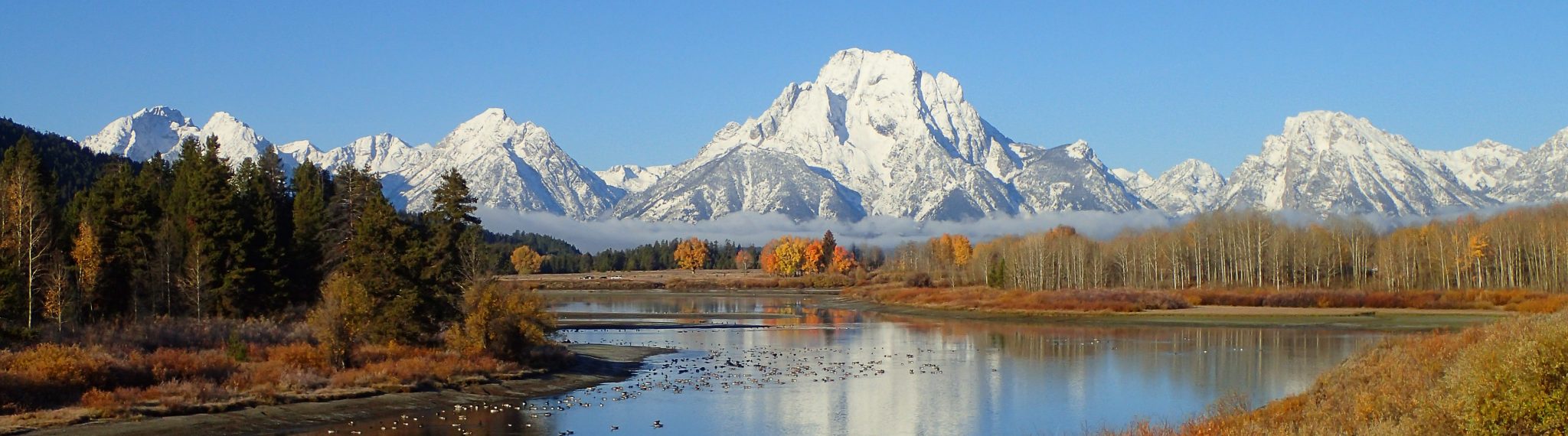
Instead of staying at the provincial campground, the group opted for a true boondocking experience on Kluane Lake at a roadside turnout. Some RVers do their whole Alaska trip staying in turnouts along the highways, of which there are many. I’m too much of a control-freak and like my reserved campsites, so we haven’t used that approach (plus we like full hookups most of the time). But we knew about this turnout from the trip north and it did provide a beautiful view of Kluane Lake and the Kluane Range of mountains that make up Kluane National Park.
Our boondocking site on Kluane Lake
Wildflowers are still in bloom at Kluane Lake.
Though we had a bit of a rainstorm upon arrival, otherwise, this was a lovely and memorable camping spot for the night.
Day 58
We woke up to a beautiful sunrise over Kluane Lake with views of the stunning Kluane Range around us.
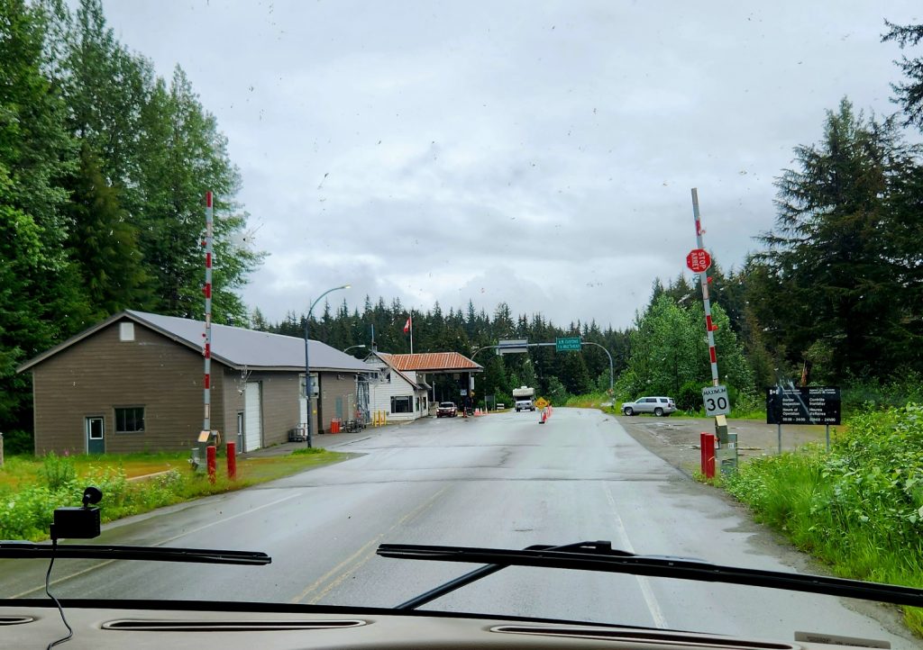
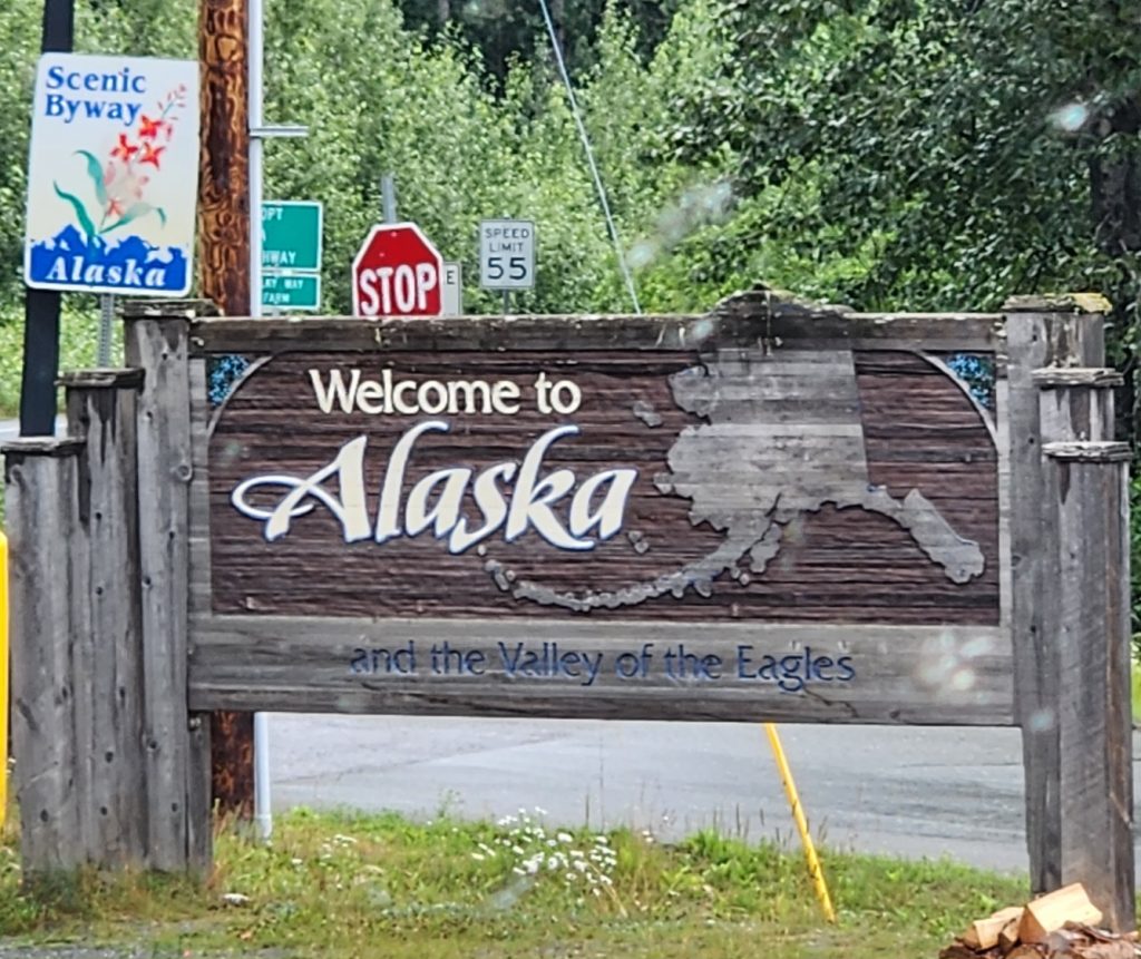
Today we backtracked a little further down the Alaska Highway, again enjoying gorgeous mountains along the way. At Haines Junction, we turned south to explore the Haines Highway, exiting the Yukon, entering British Columbia, and then once again entering Alaska and the town of Haines, Alaska. The border crossing went smoothly, and we’re getting used to the different questions that the U.S. Customs/Border Patrol personnel ask vs. those that the Canadian personnel ask. We’ll have a few more border crossings before we’re finished.
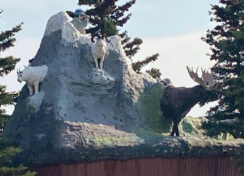
We never did see Dall sheep, but this statue in Haines Junction shows what they look like (Ron's photo).
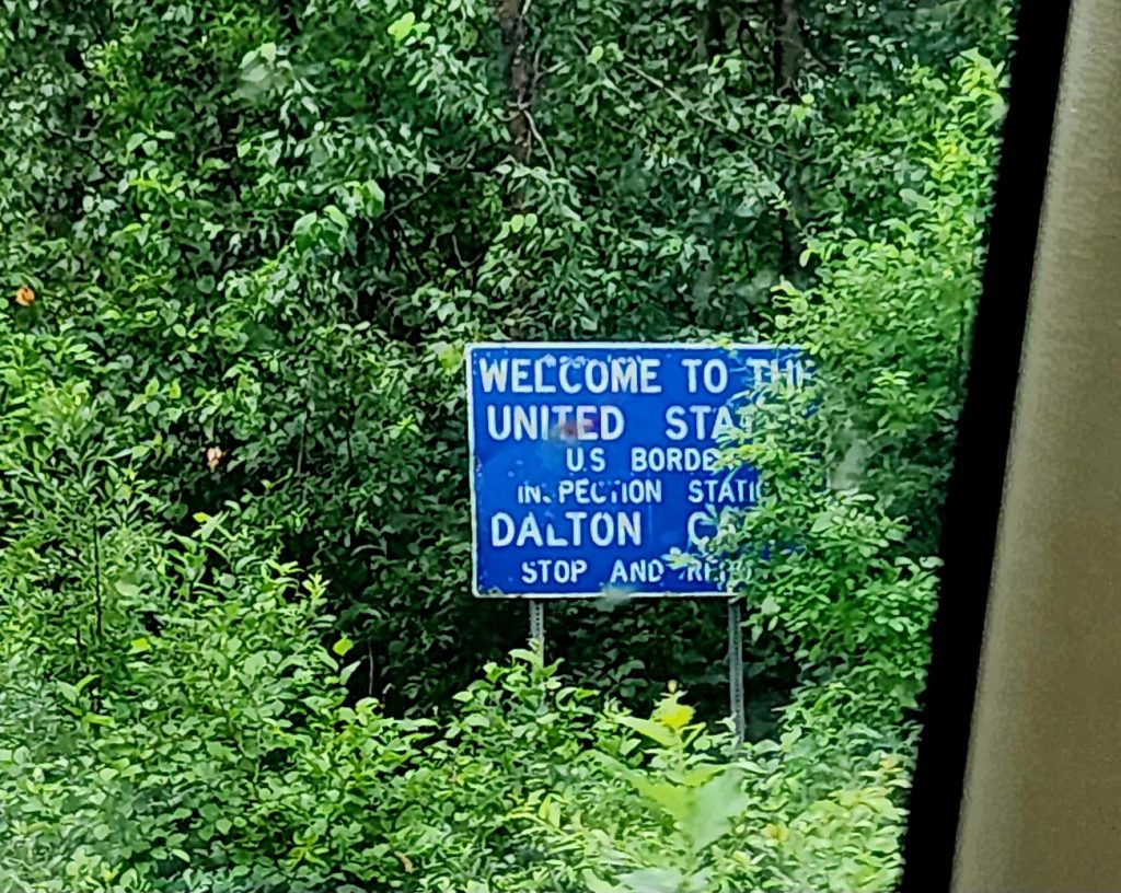
Crossing from British Columbia back into the U.S./Alaska
We think they want us back?
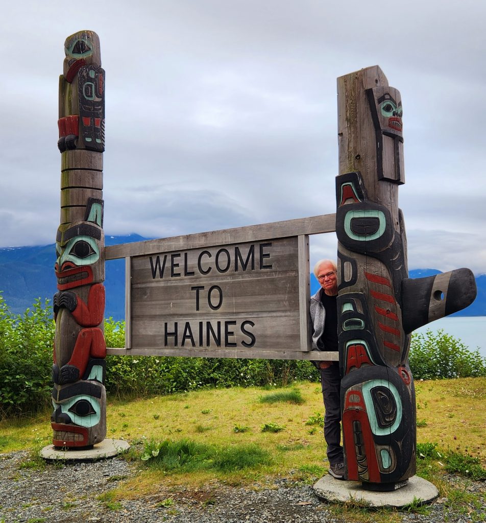
This feels more welcoming!
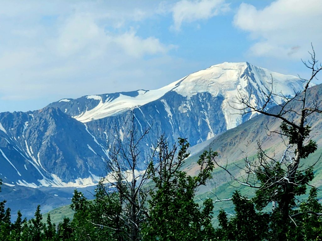
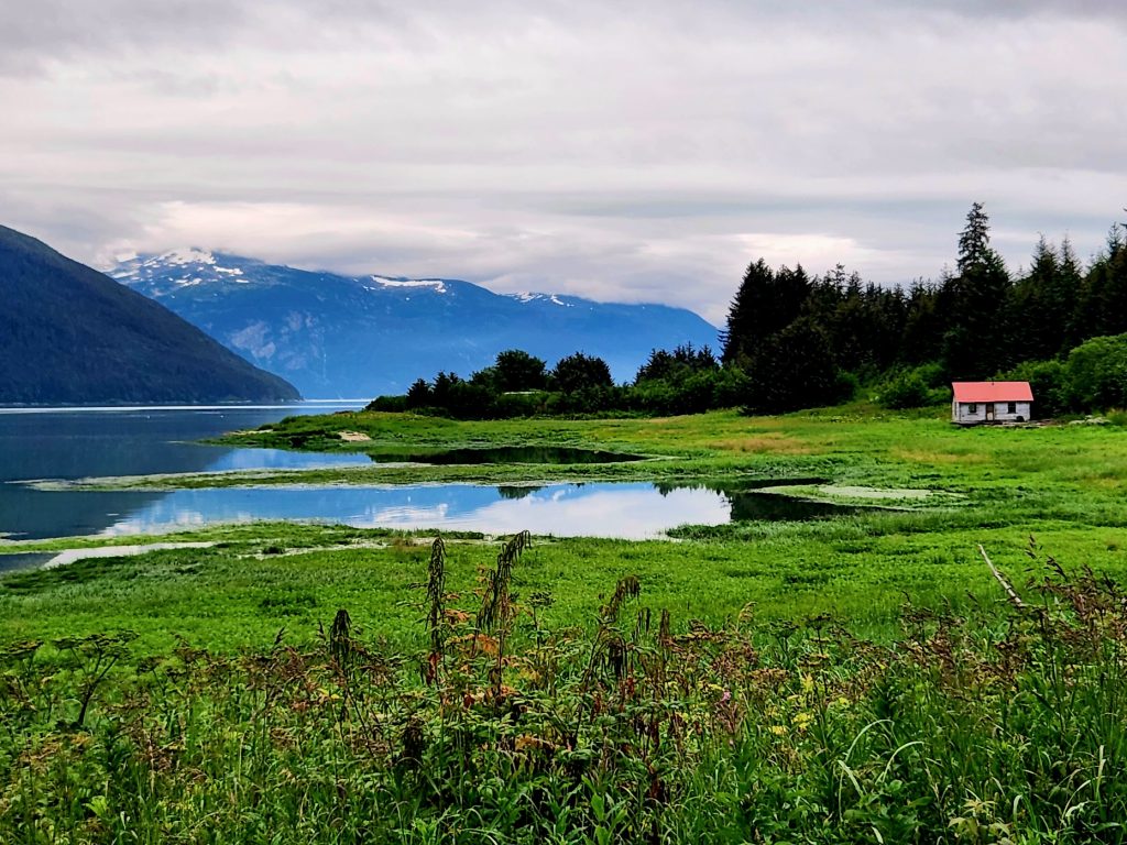
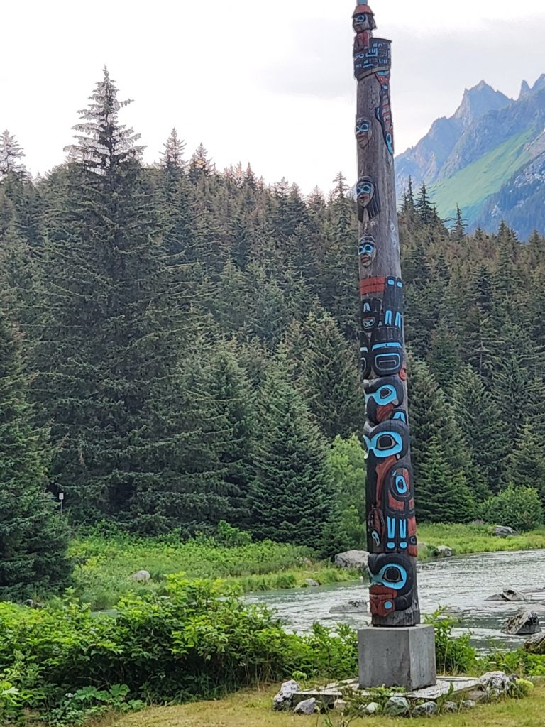
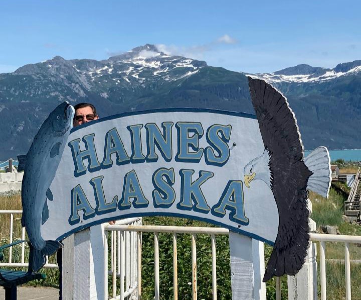
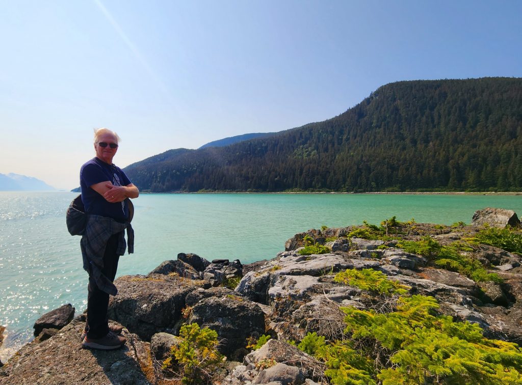
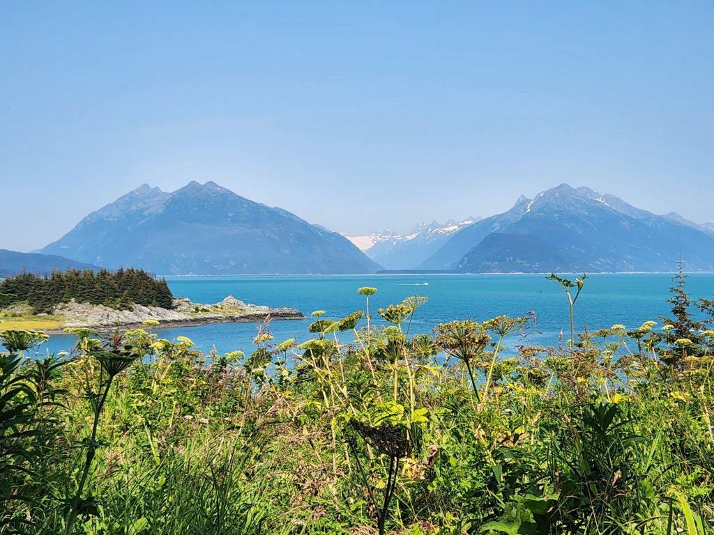
The Haines Highway was beautiful and the geography quite different from what we have previously encountered. For those of you who have done an Alaskan cruise, you may have been to Haines. It is kind of at the top of Glacier Bay/Inside Passage, north of Juneau. Haines is one of only three places in Southeast Alaska (the panhandle) that you can drive to. So, of course, we had to go there (more about the other two places coming up). This area was largely inhabited by Tlingit bands of Native Alaskans, and they often carved totem poles to represent significant events in their lives and community.
There seem to be a million different beautiful mountains in this area.
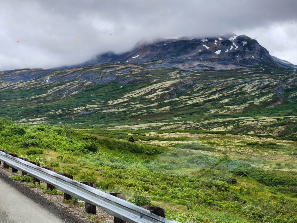
The mountains looked different as we headed further south.
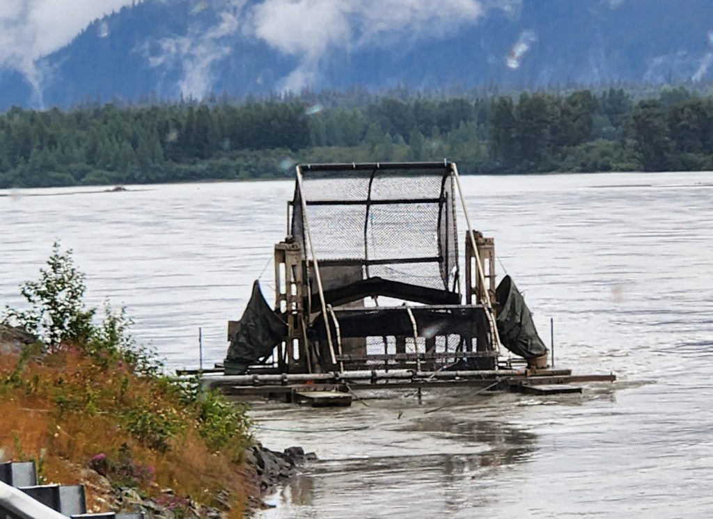
A fish wheel on the Chilkat River
There are totem poles all over the Haines area--wonderful!
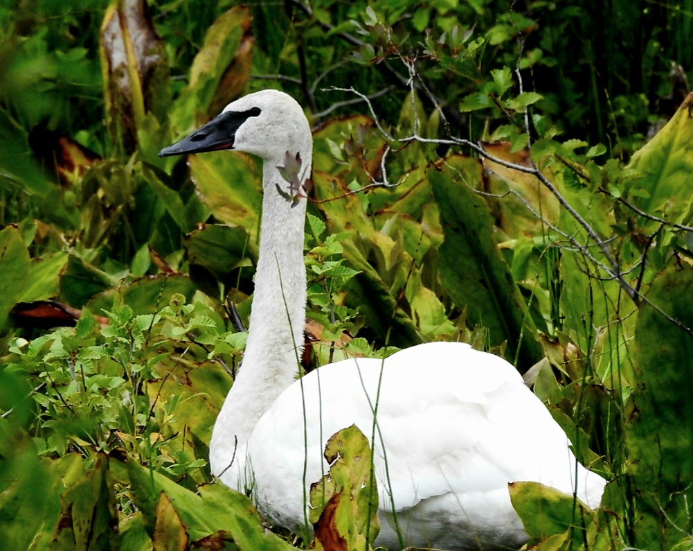
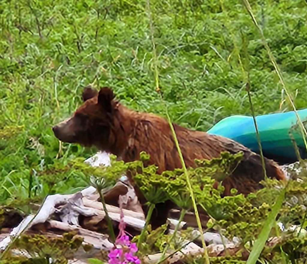
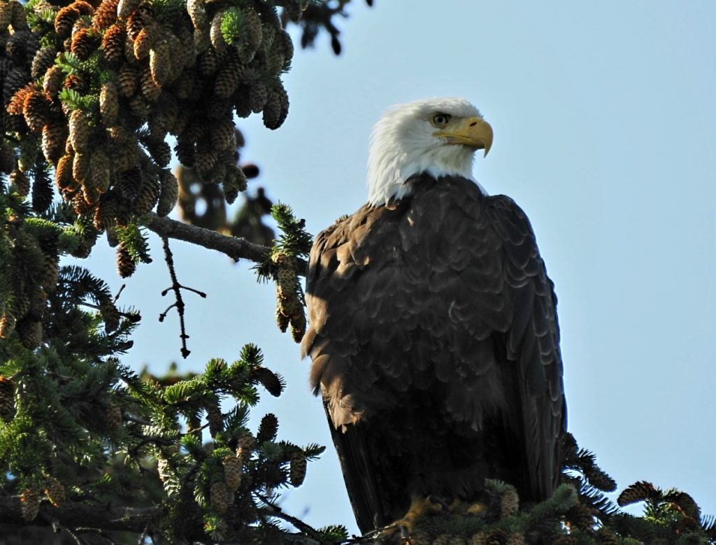
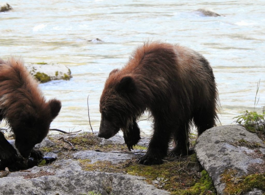
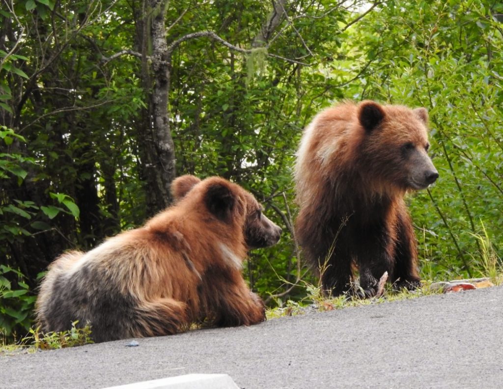
Since Hank and I were still self-isolating but feeling pretty good, we drove out of town to photograph two trumpeter swans off the Haines Highway, four coastal brown bears (a.k.a. grizzlies–two adults and two cubs) on Lutak Inlet, and four bald eagles in and around Chilkoot Lake State Park.
A trumpeter swan off the Haines Highway
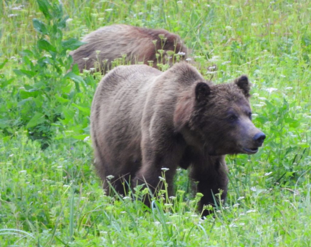
Mama grizzly foraging for sedge grass.
What a beautiful spot to do bear viewing!
One cub explores some abandoned outdoor furniture.
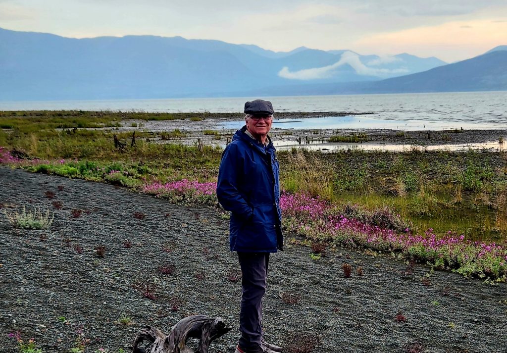
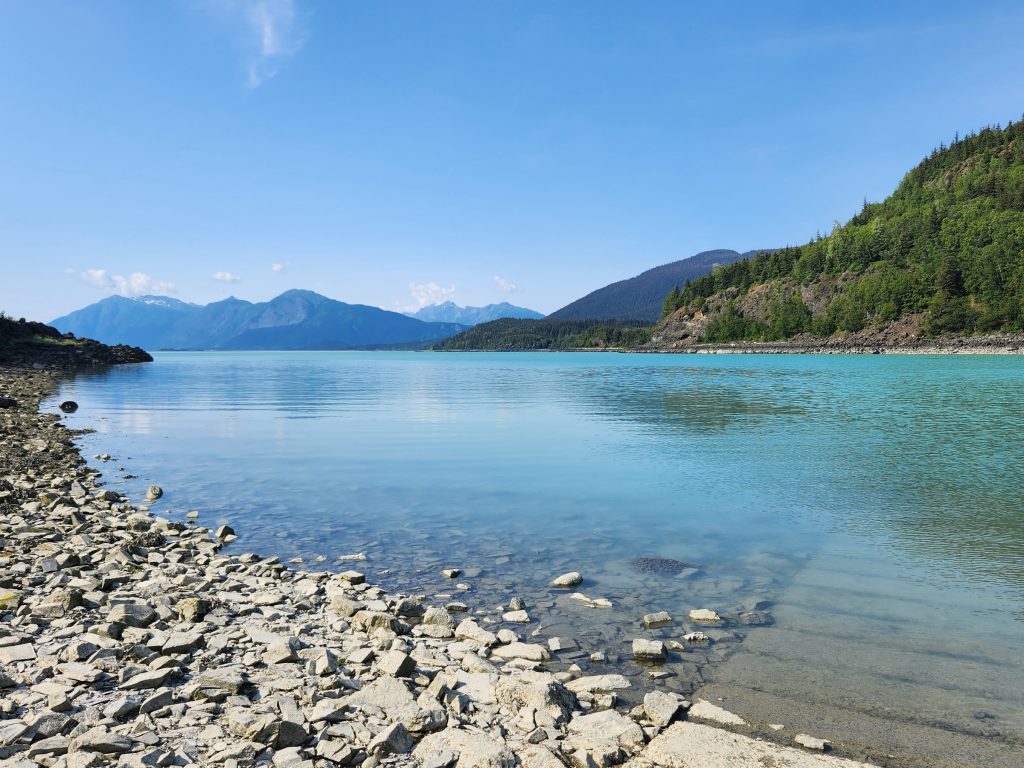
Day 59 One more day of isolating—what to do? Clean the RV, do laundry, and go look for more critters. Today we headed south from Haines along Mud Bay Road to Chilkat State Park. What a gorgeous drive! The area around Haines reminds me a lot of the Puget Sound area of Western Washington state. If you could move the Olympic Range of mountains right next to Harstine Island (and put the mountains on three different sides of the mainland), that’s what Haines feels like–lush forests, large evergreen trees (that are much larger than in Interior Alaska because it’s a milder climate here), with huge mountain peaks surrounding the entire area.
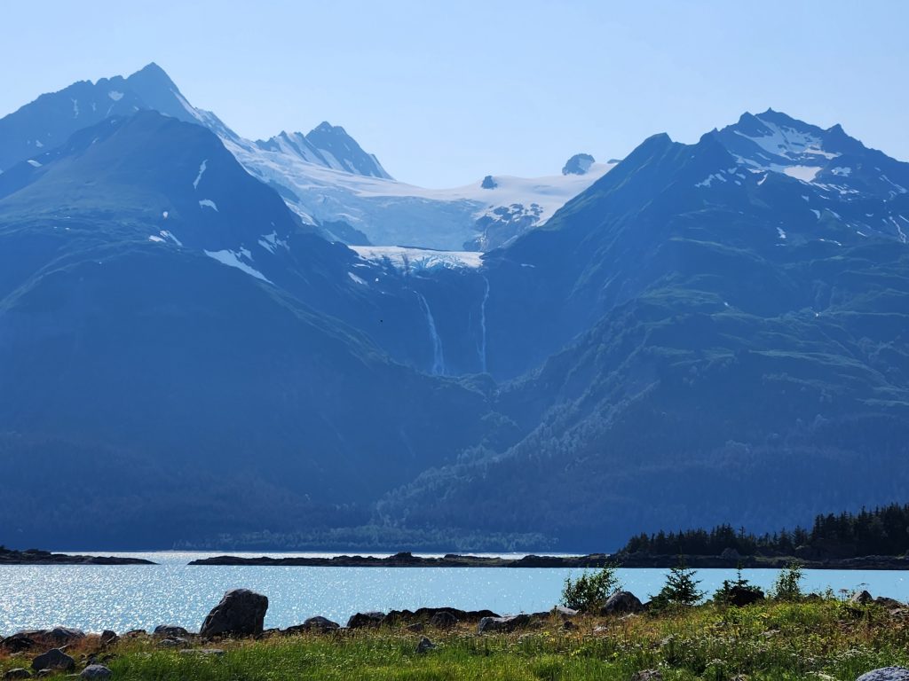
We didn’t see any bears in Chilkat State Park, but we saw two more bald eagles, and beautiful glaciers around this area where the Chilkat River empties into Lynn Canal.
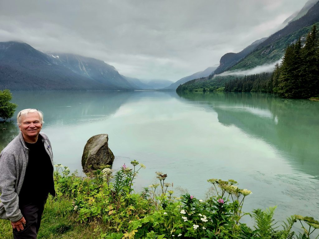
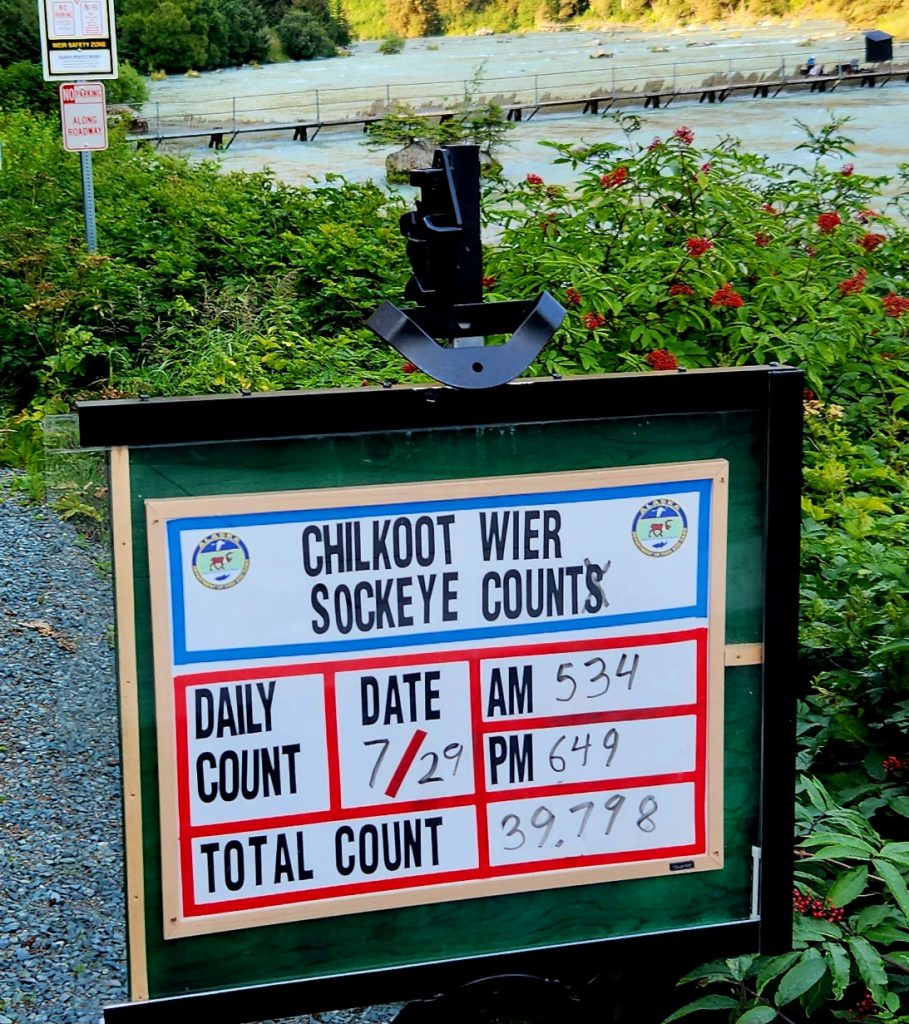
In the evening, we again drove up to Lutak Inlet to try and find our four grizzlies. They weren’t in the same spot as the night before, but we heard they had been spotted near the fish weir. After enjoying beautiful views of Chilkoot Lake, we planted ourselves near the fish weir and waited. This fish weir is operated by the Alaska Department of Fish & Game, and its purpose is to count the sockeye salmon returning to the lake and river each year.
Chilkoot Lake is stunning!
The fish weir in the background monitors the number of sockeye salmon that swim upriver.
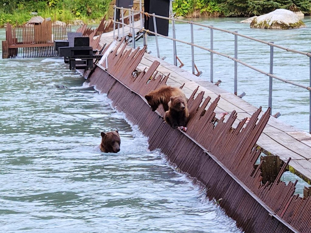
The bears have figured out how to make use of the fish weir for their own fishing.
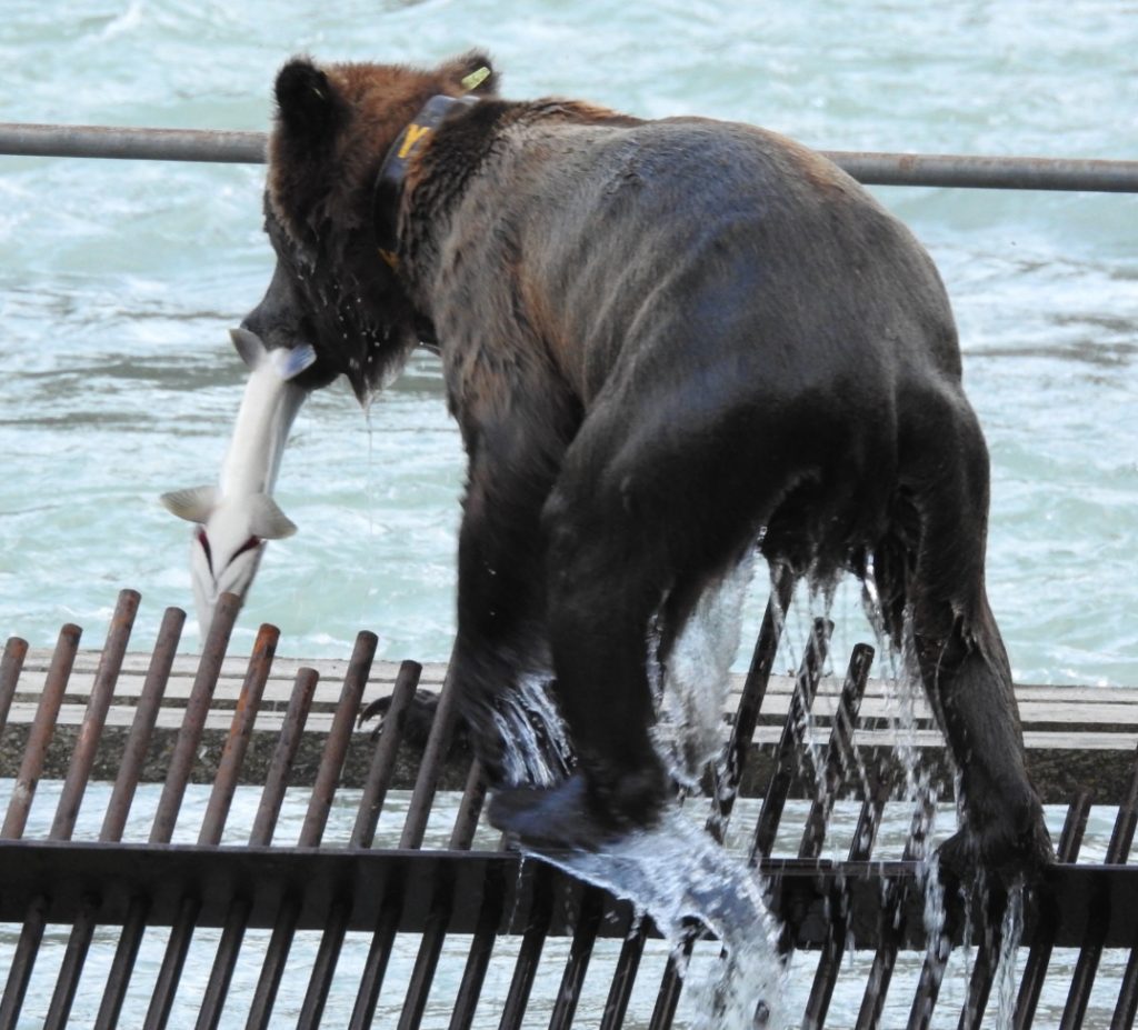
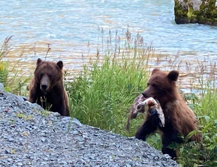
Eventually a mama grizzly and two cubs walked right onto the weir, mama grabbed a fish from the weir and the three of them ran off the weir, presumably to eat the fish. A few minutes later, mama returned (alone this time), grabbed another fish and headed back into the woods. We figured that the first fish was for the cubs and the second fish was for mama herself. It was very fun to watch how the bears have figured out how to use the fish weir to their advantage.
This fish is for me!
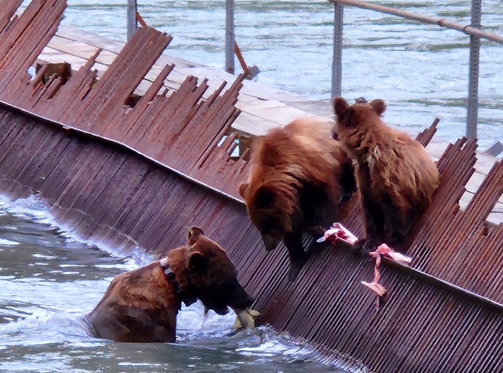
Okay, kids, you're getting the hang of this fishing thing.
Day 60 We are officially out of self-isolation from Covid today, but still being cautious about being around people. And we still need a bit of extra rest, though we’re doing better each day. Our trip is officially 75% over, with 20 more days to go.
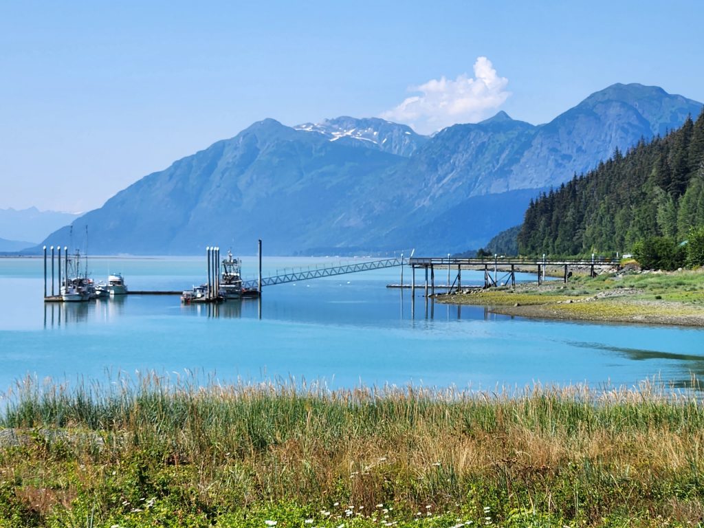
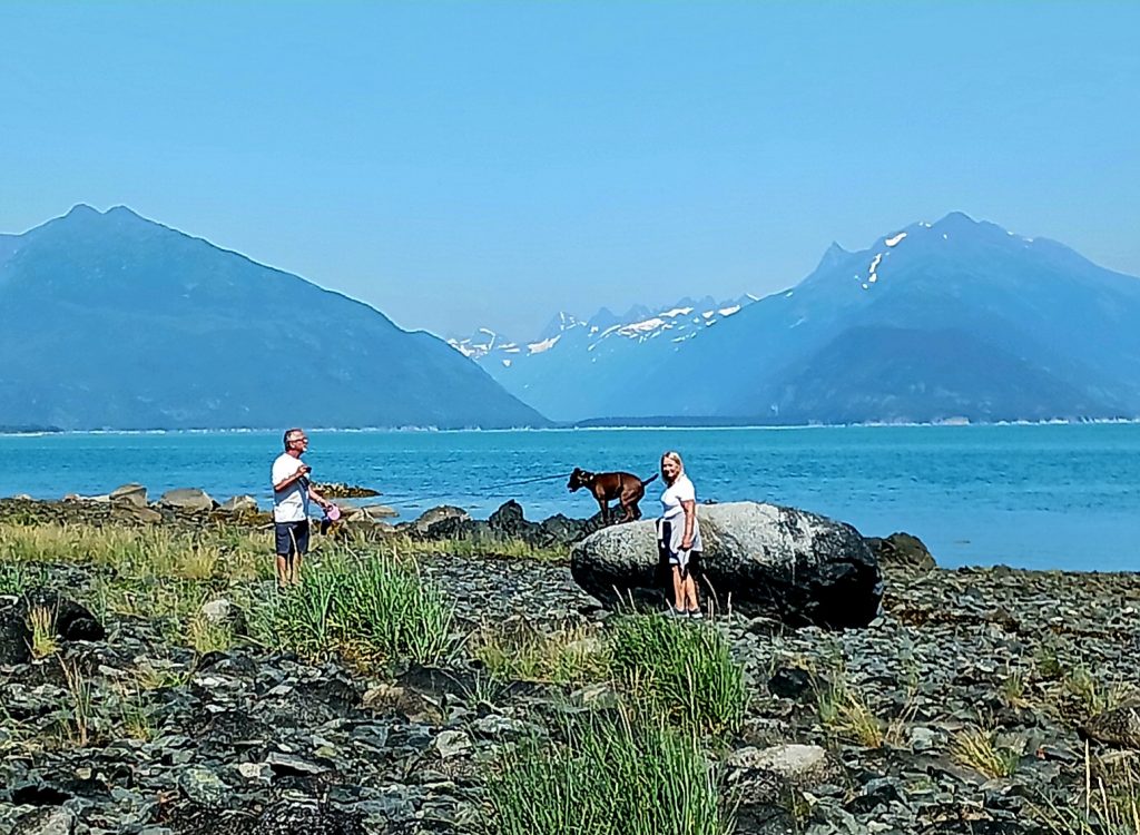
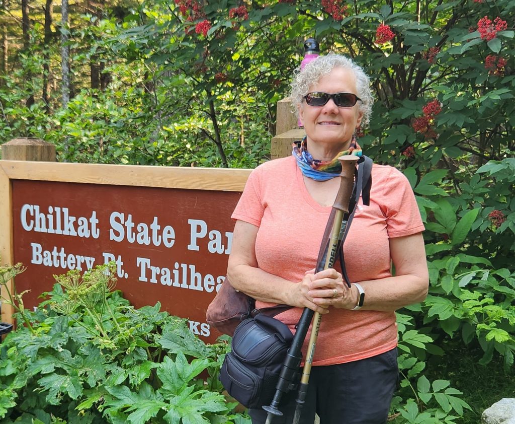
Today we drove to a new part of the peninsula on which Haines sits, the end of Mud Bay Road, and Beach Road to the Battery Point trailhead. We didn’t feel up to a hike, but the views were still beautiful. Haines is what Jane Austen would call “well-situated,” in a perfect location with mountains, rivers, inlets, and bays surrounding it.
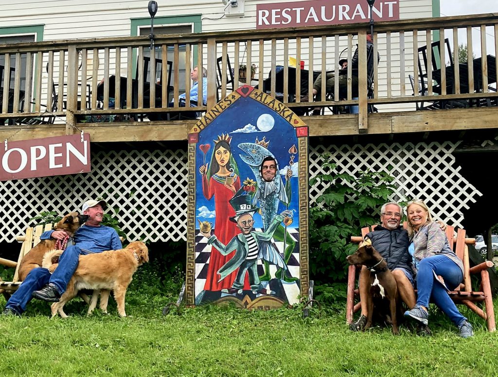
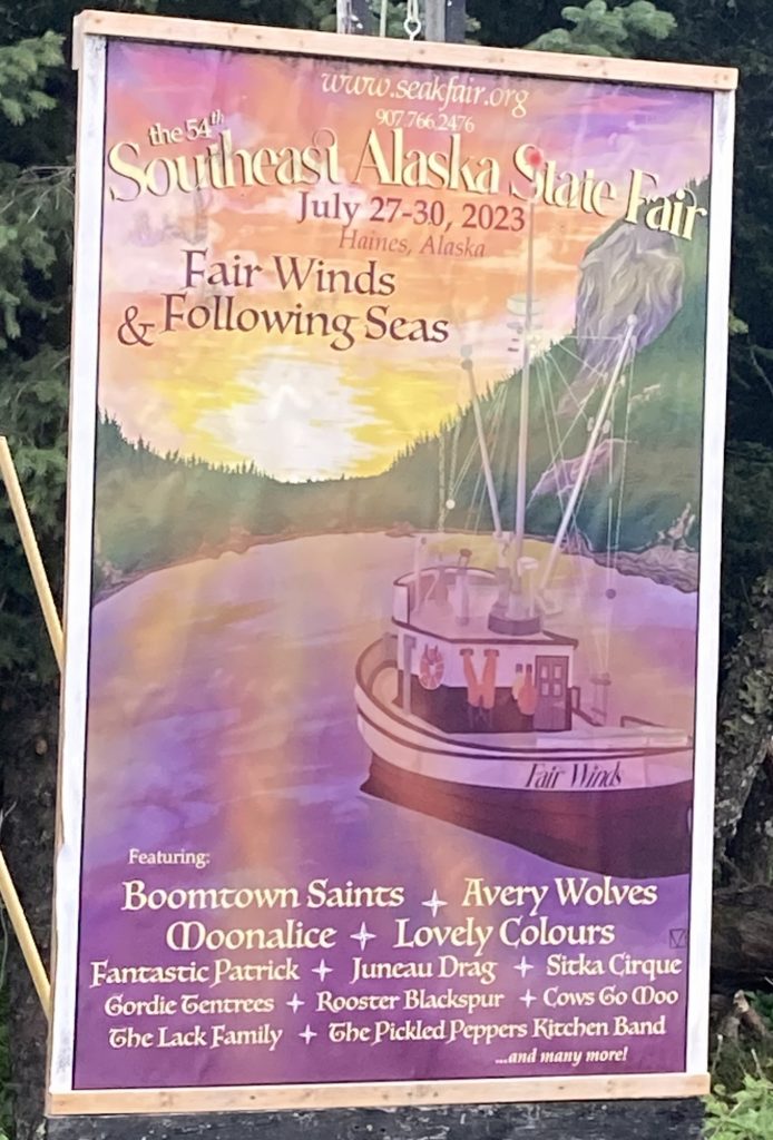
Other members of our group explored some of the outdoor and indoor sights of Haines, plus visited the Southeast Alaska Fair, which was going on this weekend.
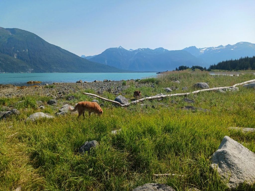
Tom, Ron and June took the dogs to Kelgaya Point (Tom's photo)
Blazer and Luna explore the beach (Tom's photo)
Blazer on the hike (Tom's photo)
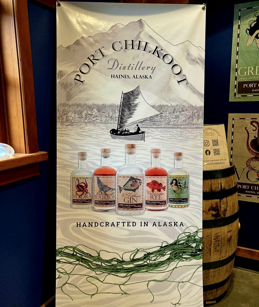
Judy's photo at the Port Chilkoot Distillery
Where's Allyn? (Judy's photo)
Now where's Allyn? (Judy's photo)
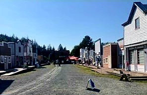
Judy and Allyn visited the fair (Judy's photo), which was like a small carnival.
The fair uses sets from White Fang, filmed nearby (Allyn's photo).
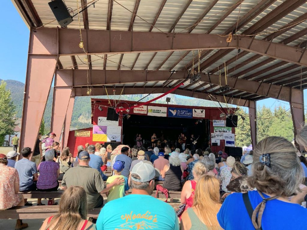
Live music by local performers could be heard all the way to our campground.
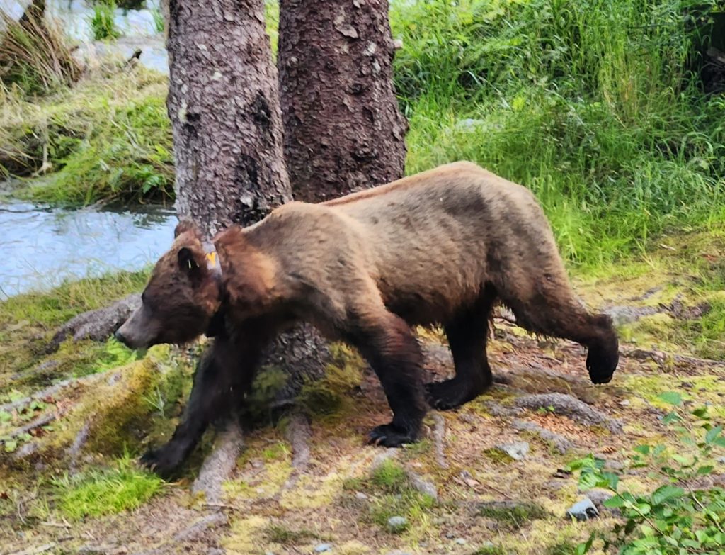
In the evening we again drove along Lutak Inlet to see if we could find more bear activity. As we approached the fish weir, we were startled to find the two cubs munching on fish right next to the road with mama bear very close at hand. Judy and I got out of our cars as quickly and safely as we could while our husbands looked for parking. The bears were moving across the road, and we had to get out of their way!
The cubs right next to the road
Look, Mom! We can catch fish too! (Judy's photo)
Eventually the three bears came back out of the forest onto the fish weir and did some more fishing. Though it was hard to get good photos, we had a blast just watching the bears grab salmon and begin to eat right on the weir. As before, the mama caught a big fish and marched off the weir in the other direction, followed by her bounding little offspring. Amazingly cute and such a privilege to watch! Who needs TV when you have this kind of viewing? Check out our 3-minute compilation of our video footage on the bears around Haines.
Day 61 We had planned to take the pedestrian ferry to Skagway to explore the Klondike Gold Rush buildings and take the train up to White Pass, but with the Southeast Alaska Fair going on, they’ve cut back on the ferry options, so we couldn’t make it work (we’ll have to save that side trip for next time). Skagway is the second town in Southeast Alaska you can drive to, but we couldn’t fit that route in along with Haines, so we had hoped the ferry would work–oh well!
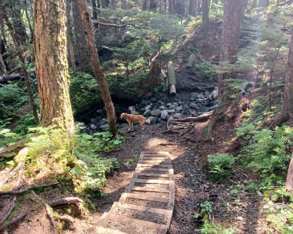
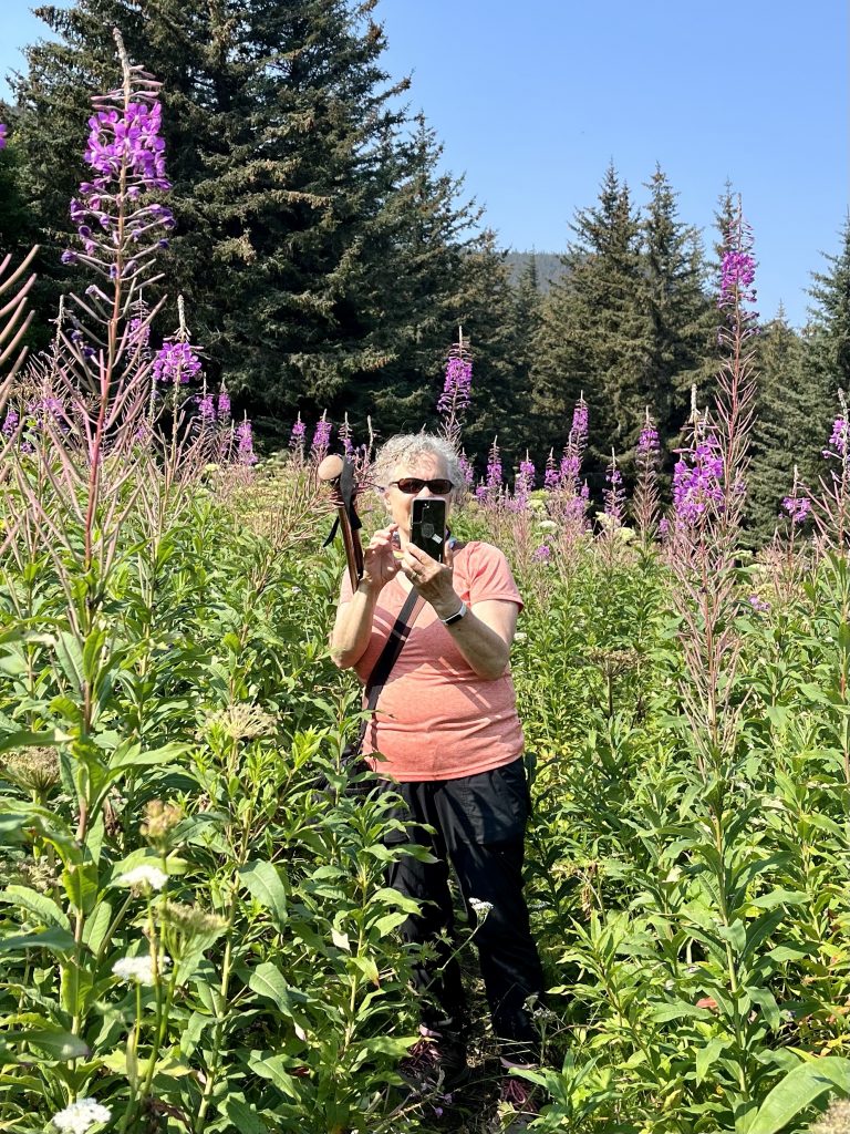
But feeling a bit more energetic today, we decided to tackle the Battery Point Trail in Chilkat State Park south of town. Battery Point is on a peninsula overlooking a narrow and shallow portion of Chilkoot Inlet. Sometimes you can see humpback whales from the point. We greatly enjoyed this 4-mile round trip hike through old-growth forest and neck-high wildflowers and sedge grass (what grizzlies like to eat!) to a broad view of the surrounding peaks and waterways.
The wildflowers and sedge grasses were taller than us.
We didn’t see any humpbacks, but it was still a very enjoyable hike, and we felt encouraged that we could do this hike after just getting over Covid. We were glad it wasn’t any steeper or longer.
The view from Battery Point
The views are so stunning, they almost seem fake.
For our last night in Haines, we drove back up to the Chilkoot Lake State Recreation Site. We waited at the fish weir with about 20 other people. When the coastal brown bears (grizzlies) were spotted further down the river, there was a mass exodus to get pictures. Yes, it was the same three we had been seeing each night—mama with her two cubs. They caught a fish, and the cubs ate it right on the side of the road. Then they all scampered into the woods, and went back and forth across the road to the fish weir. We had to work hard to stay out of their way, but they were very intent on fishing and eating.
Where did you cubs go? It's time for more fishing!
It was a wonderful way to end our time in Haines. We’ll be leaving Alaska again tomorrow, but not for the last time (yet!).
Here are a few other shots from this leg of the trip. Next time we’ll hit the third and final place in Southeast Alaska that you can drive to (besides Haines and Skagway)–as we travel down the Cassiar Highway.
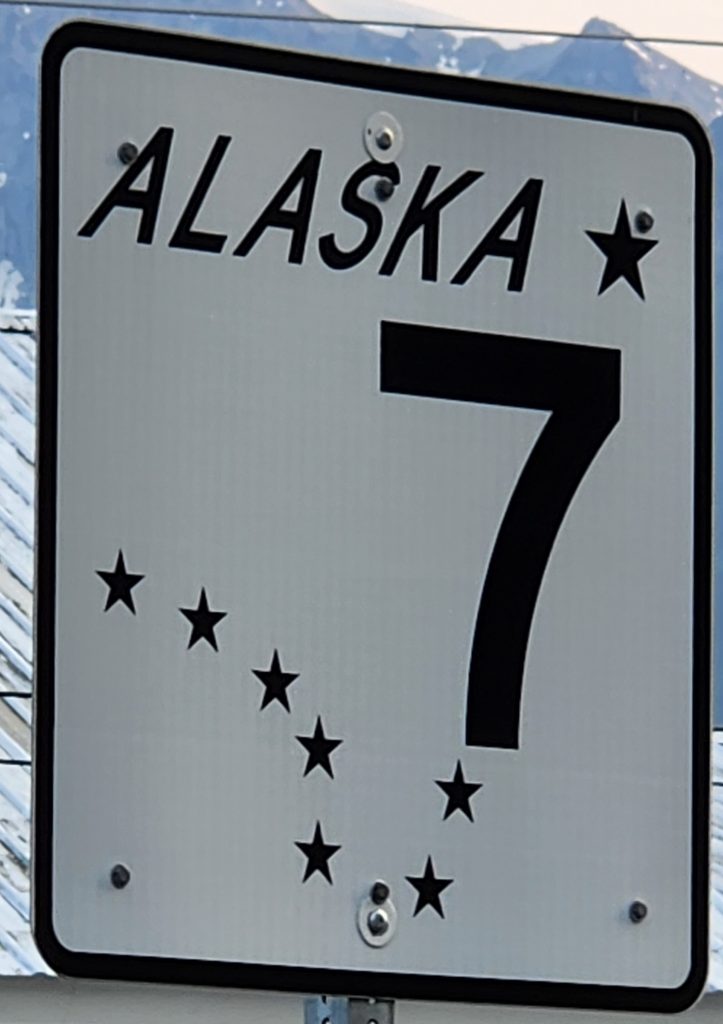
We've been calling our group the "Alaska 7," and it's nice that they had a road sign just for us!
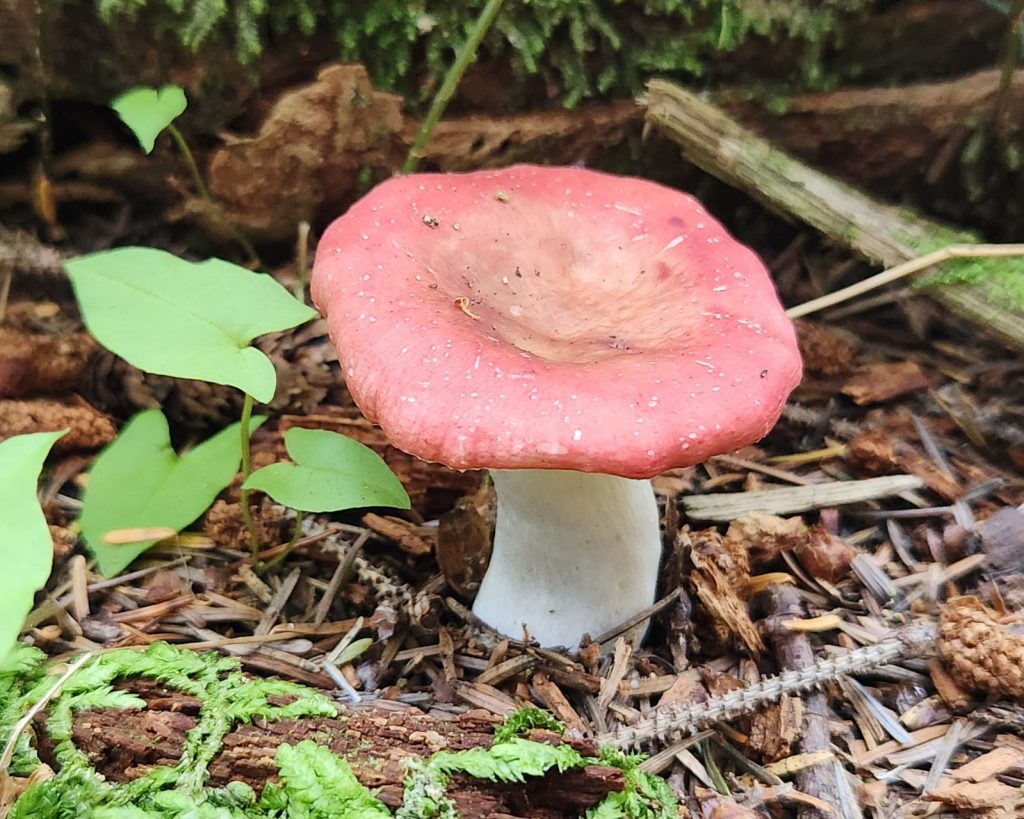
The fungus of Haines
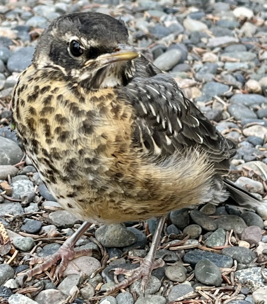
American robin in Tok
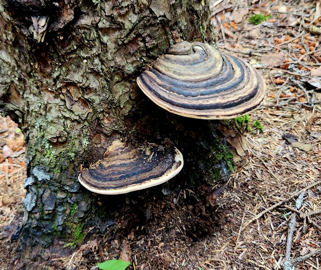
More fungus of Haines!
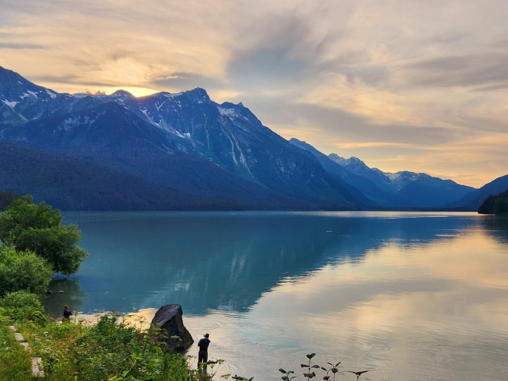
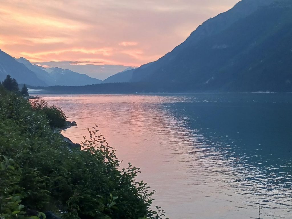
Tom's photo of the sunset over Chilkoot Lake
4 thoughts on “Alaska-Part 9-Leaving Alaska and Re-entering Alaska!”
Cindy and Hank…once again, what a fascinating blog…we so feel we are all traveling with the Alaska on this phenomenal journey….
Hank, let your mind wander back to August 4th , 1973 as Marleen and I celebrate our 50th Anniversary this week…we are quietly celebrating in Pasadena and retracing all of our early memories from getting engaged at the Huntington Library in San Marino to our reception at the La Canada Country Club….what a journey this has been!
Sending our love your way….
Q
Jim! 50 years! Great cause for celebration for sure. Enjoy that trip down memory lane in Pasadena. Quite a journey for you two!
What an amazing post. I get a vicarious thrill seeing the grizzlies. (Like you, I especially love the wildlife.)
Lynn, We’re so glad you enjoy seeing the bear pictures! We sure love seeing them in real life!
Cindy