Part 3: Driving the Alaska Highway through Western Canada
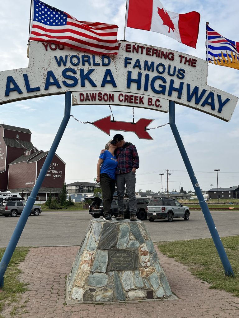
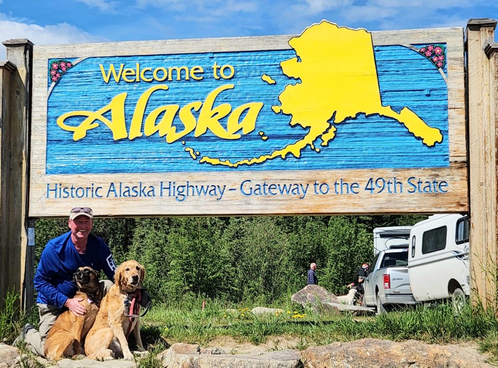
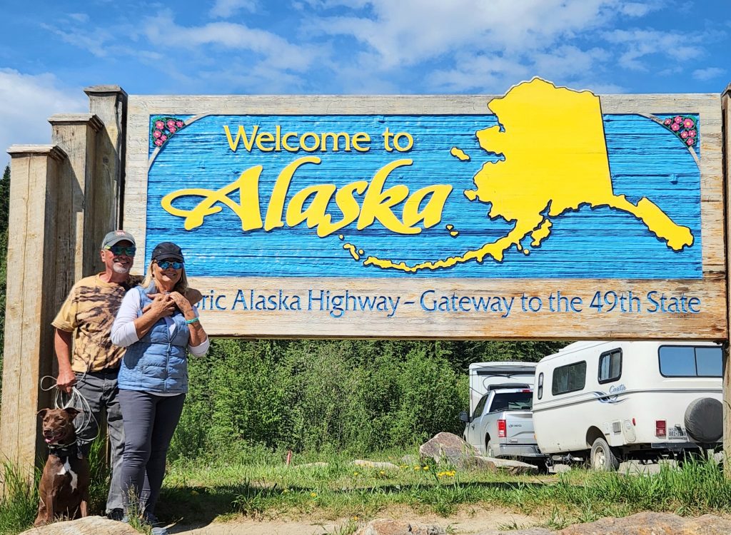
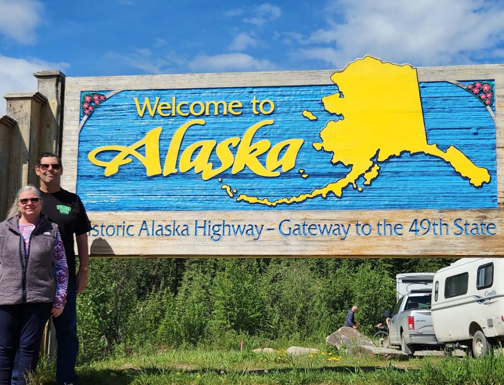
Day 13 This part of our journey entailed driving most of the Alaska Highway to Tok, Alaska, the first town in Alaska via the Alaska Highway. After almost two weeks of travel from Southern California, we crossed the Rocky Mountains from west to east, and arrived yesterday at Dawson Creek, BC, famous for being Mile 0 of the Alaska Highway.
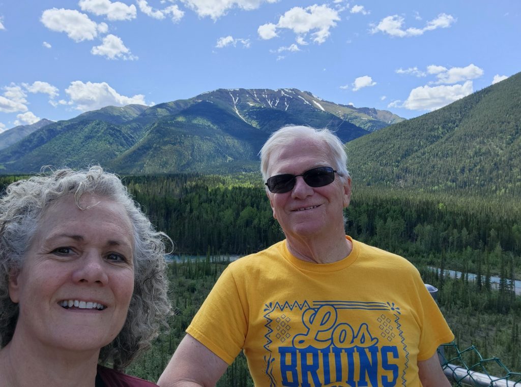
Celebrating our arrival at Mile 0!
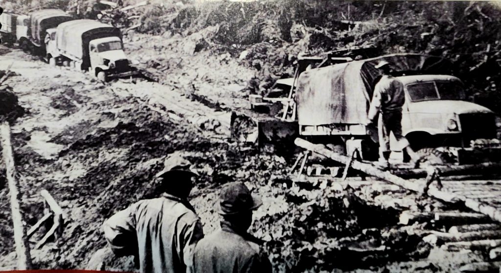
The Alaska Highway, also known as the ALCAN, was built in record time following the Japanese attack on Pearl Harbor in 1941 (at which time the U.S. entered World War II). The Aleutian Islands of Alaska are only 750 miles from Japan, and there was fear that the Japanese would attack the North American mainland through Alaska and then head into other parts of the continent.
The U.S. and Canadian governments agreed to the building of the highway and within three months of the attack on Pearl Harbor, thousands of US troops and loads of heavy equipment arrived in Dawson Creek to begin the U.S.’s most expensive construction project of the war. There were already a few airfields from Edmonton, Alberta to Fairbanks, Alaska, so that formed the basis of the route. Then surveyors and local guides determined the specific routes through mountains, along rivers, and across swamps and permafrost, mapping 8-10 miles of road per day.
Military personnel, including three regiments of African-American soldiers, worked 7 days a week constructing the actual highway, living in very tough conditions. Construction began in March, 1942, the Japanese attacked the Aleutian Islands in June, and construction of the highway ended on Oct. 25, 1942, an incredible 7-month feat of modern engineering and courage along this 1,387-mile “highway.” It opened to the public shortly after the war ended and sections have been modernized, paved, and straightened over the last 80 years.
Building the Alaska Highway was tough!
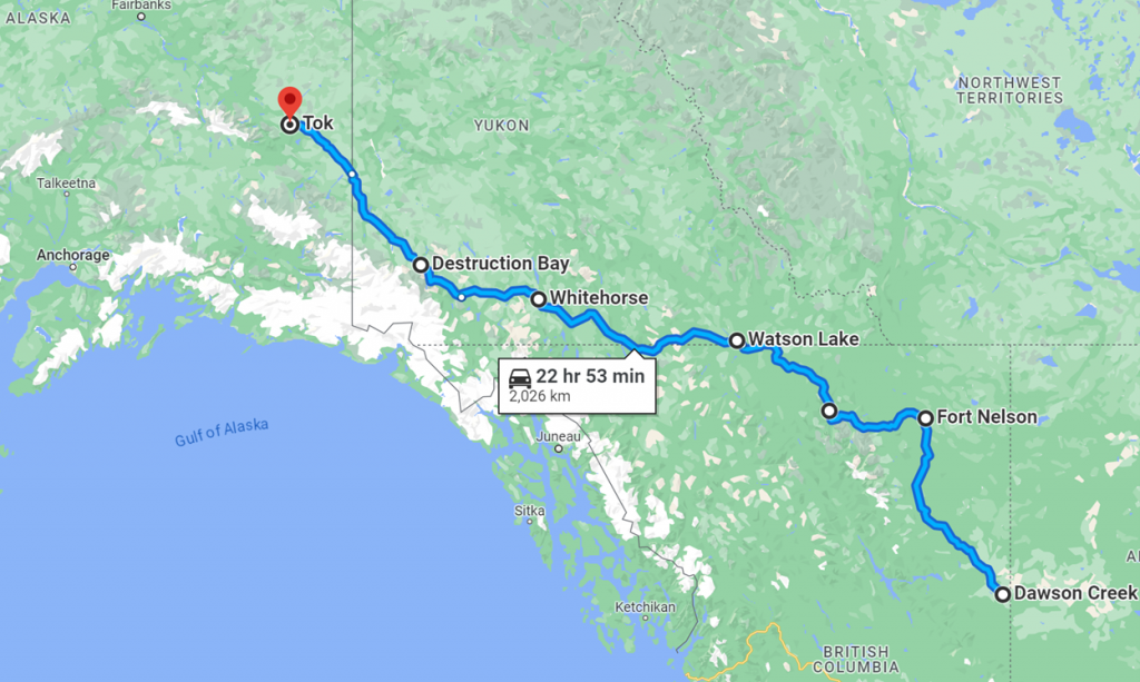
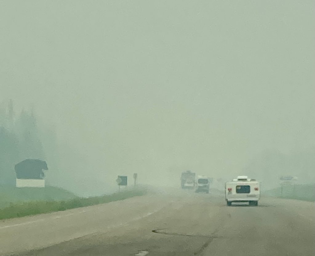
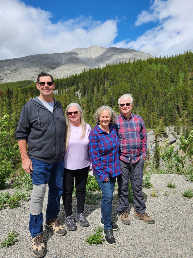
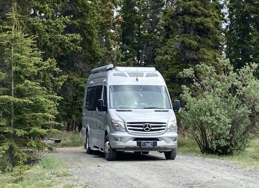
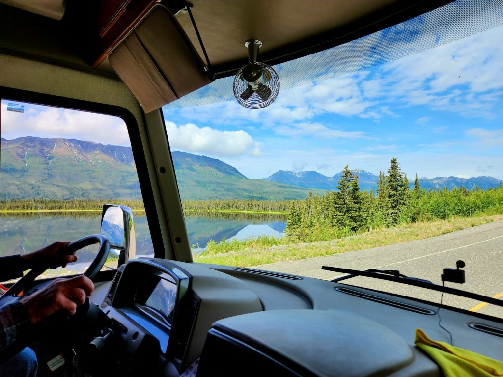
So, now it was our turn to try out this road for Phase 2 of our trip. After uniting with our Arizona group at Mile 0 in Dawson Creek, we headed out this morning for the first leg of the Alaska Highway, 282 miles from Dawson Creek to Fort Nelson, BC (the distance from Dawson Creek to Tok, Alaska is 1,256 miles). The wildfires south and east of us created a lot of smoke as we drove, but fortunately, we were never in danger from the fires.
Driving the smoky Alaska Highway--our RV, Ron/June's van, and Tom's trailer are barely visible.
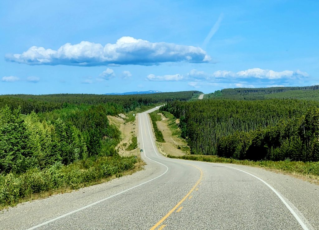
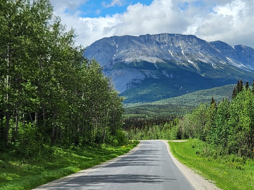
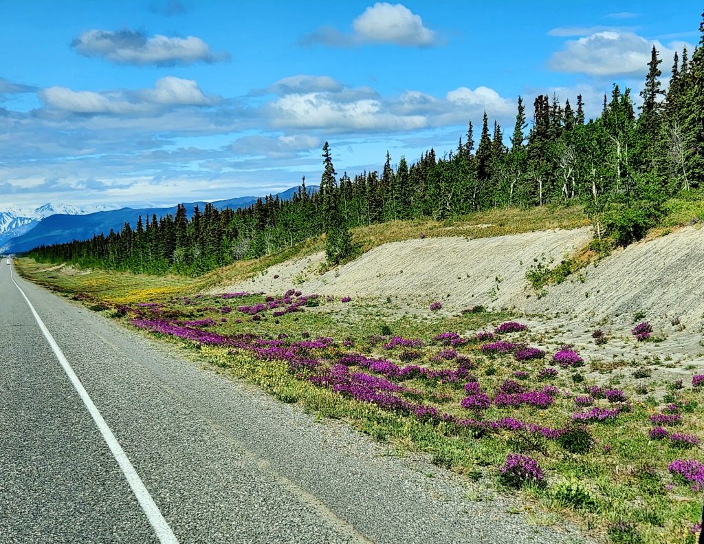
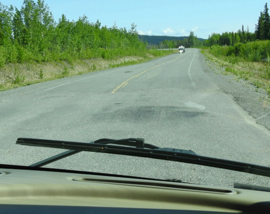
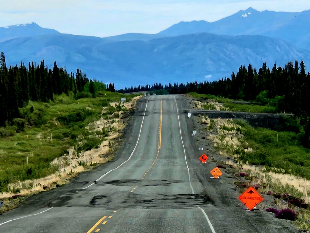
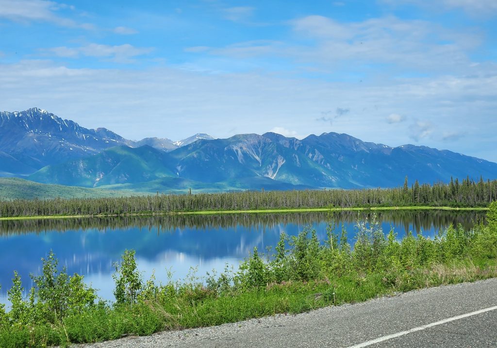
Much of the Alaska Highway looks like this.
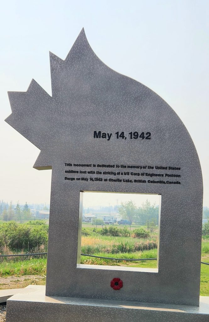
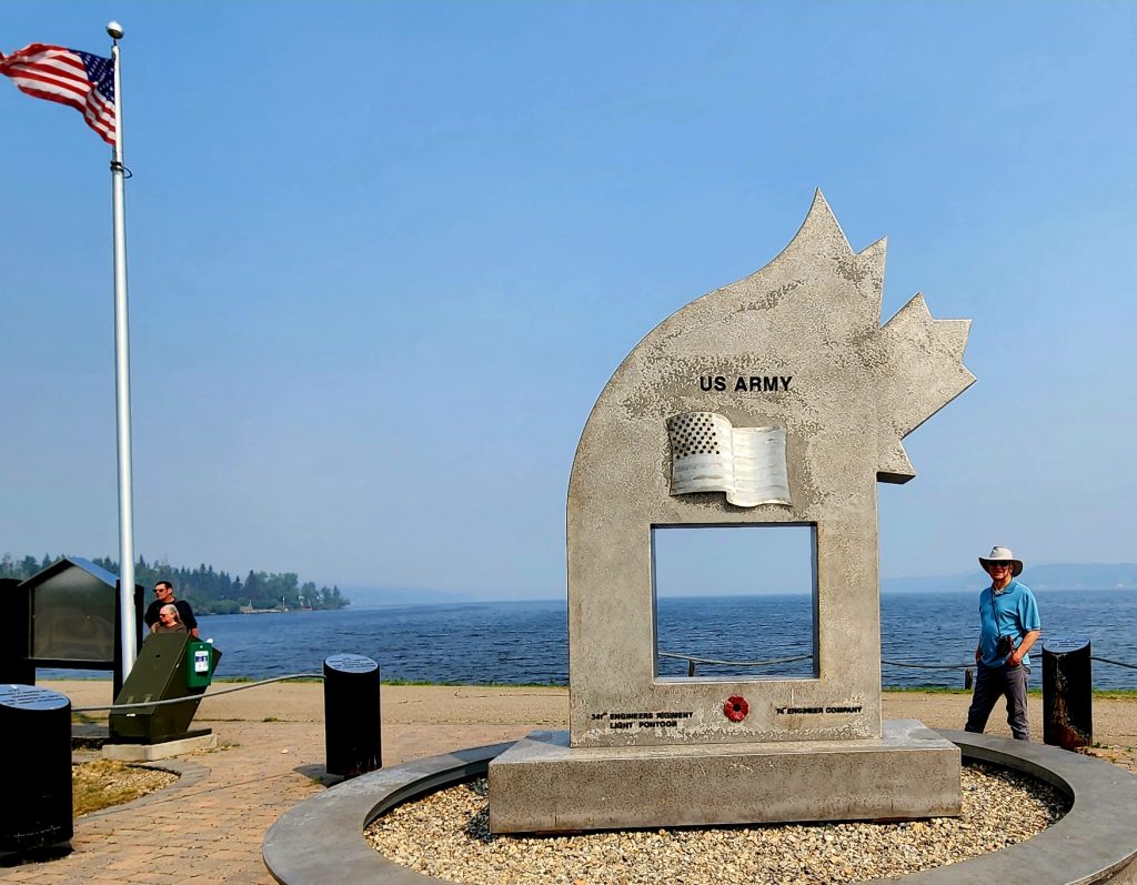
We stopped just north of Fort St. John to view the Alaska Highway monument on the shore of Charlie Lake. This 2008 memorial remembers the 12 soldiers who drowned on Charlie Lake during the early days of construction of the Alaska Highway in 1942 when their pontoon boat capsized and rapidly sank. The memorial is 12 feet high, in a 12-foot circle surrounded by 12 posts, one for each soldier who lost his life. A local resident saw the tragedy and rescued five men in his rowboat. We appreciated the opportunity to stop for a few minutes and honor the soldiers who lost their lives in the construction of the Alaska Highway.
The Alaska Highway memorial commemorates the 12 soldiers who died.
For the remainder of our drive, we enjoyed some relief from the smoke, and we loved spotting wildlife: 5 black bears and 2 sandhill cranes (no pictures because it’s hard to take photos when you’re moving at 50+ miles per hour). We arrived in Fort Nelson in northern British Columbia and joined many other RVers heading to Alaska.
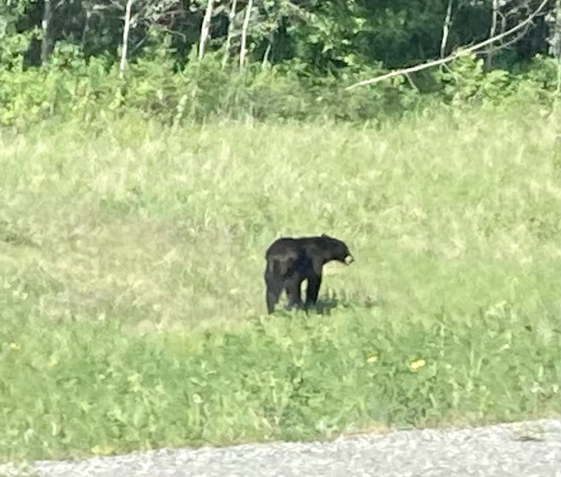
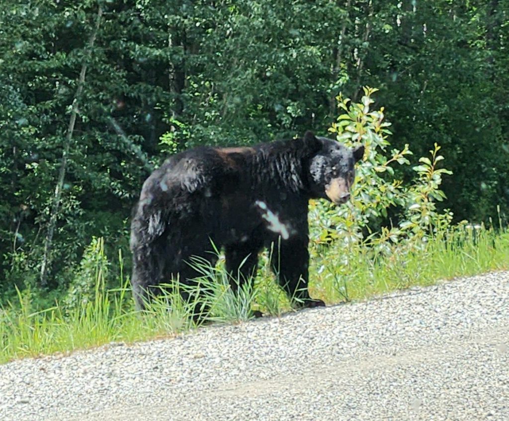
Day 14 This morning we woke up to a very smoky day in Fort Nelson. But as we headed west back over the Rocky Mountains of northern BC, the smoke disappeared, and in its place we had several wildlife sightings: 4 more black bears, including one tiny cub, a few deer, one elk, and one moose.
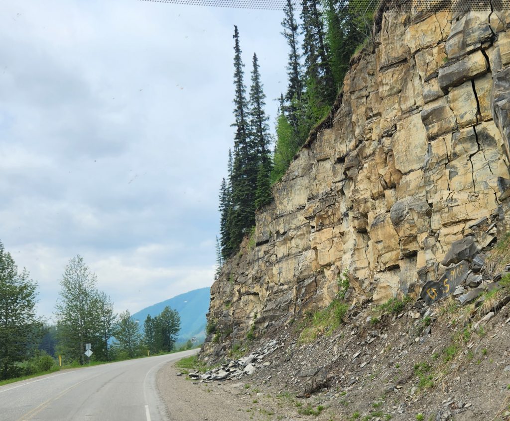
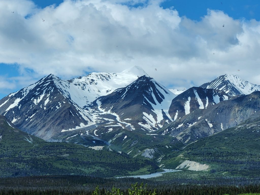
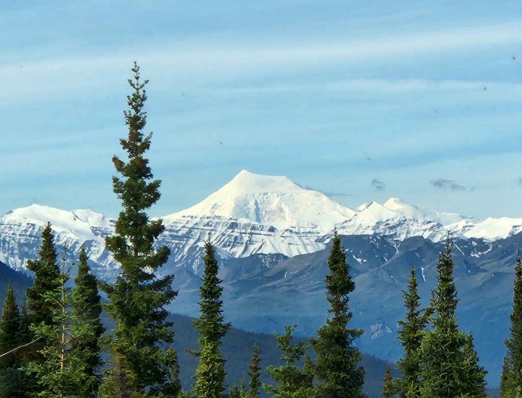
This was a beautiful drive through the mountains, including Stone Mountain Provincial Park and Muncho Lake Provincial Park, and I couldn’t stop taking pictures.
Judy snapped this black bear picture from their RV.
Stone Mountain in the background
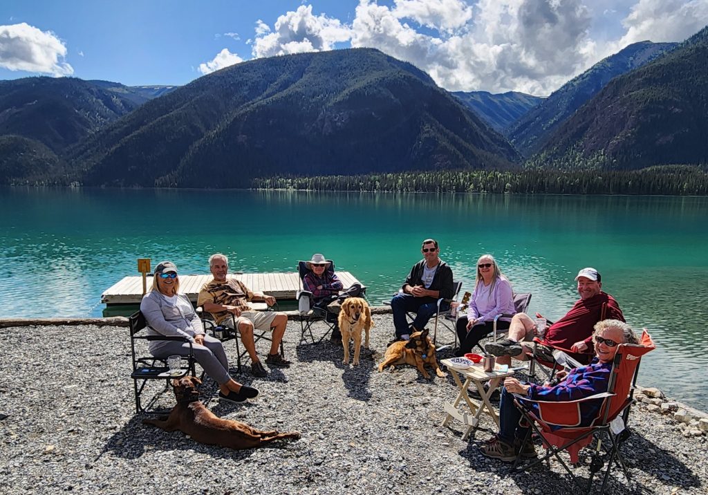
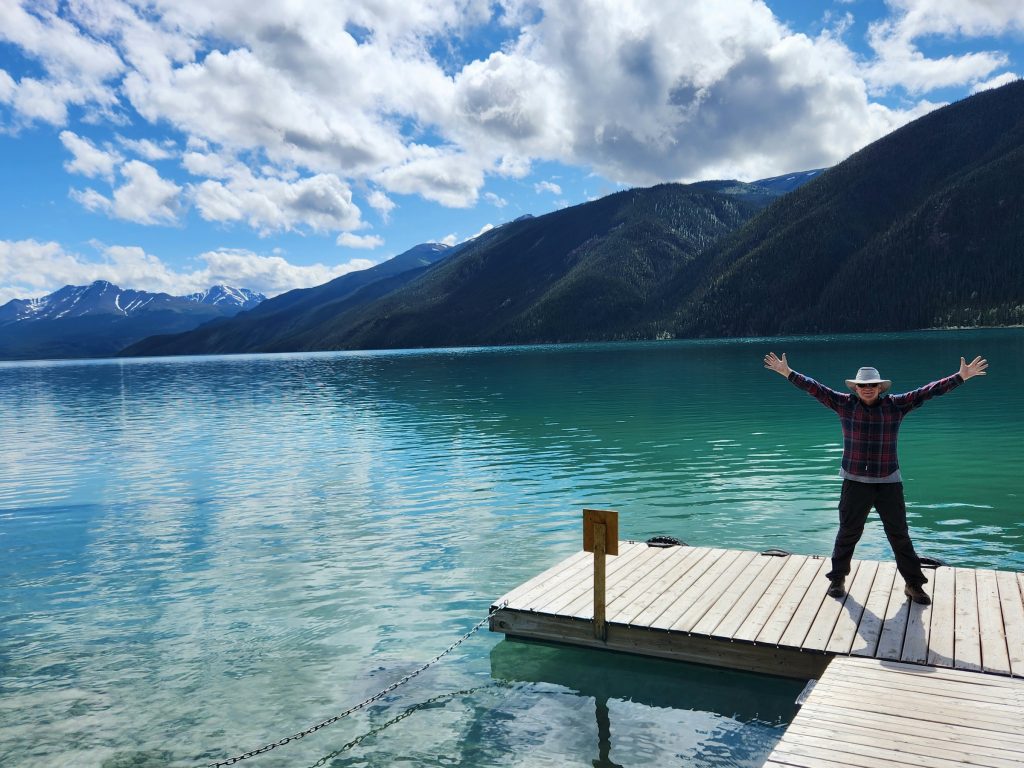
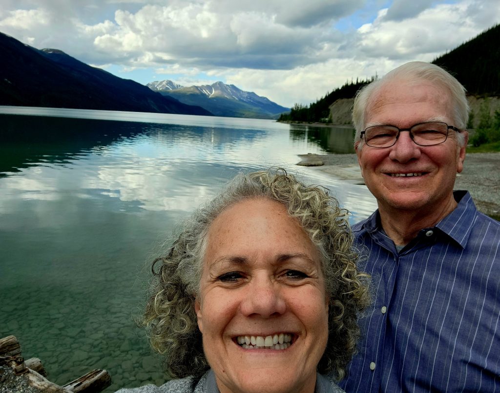
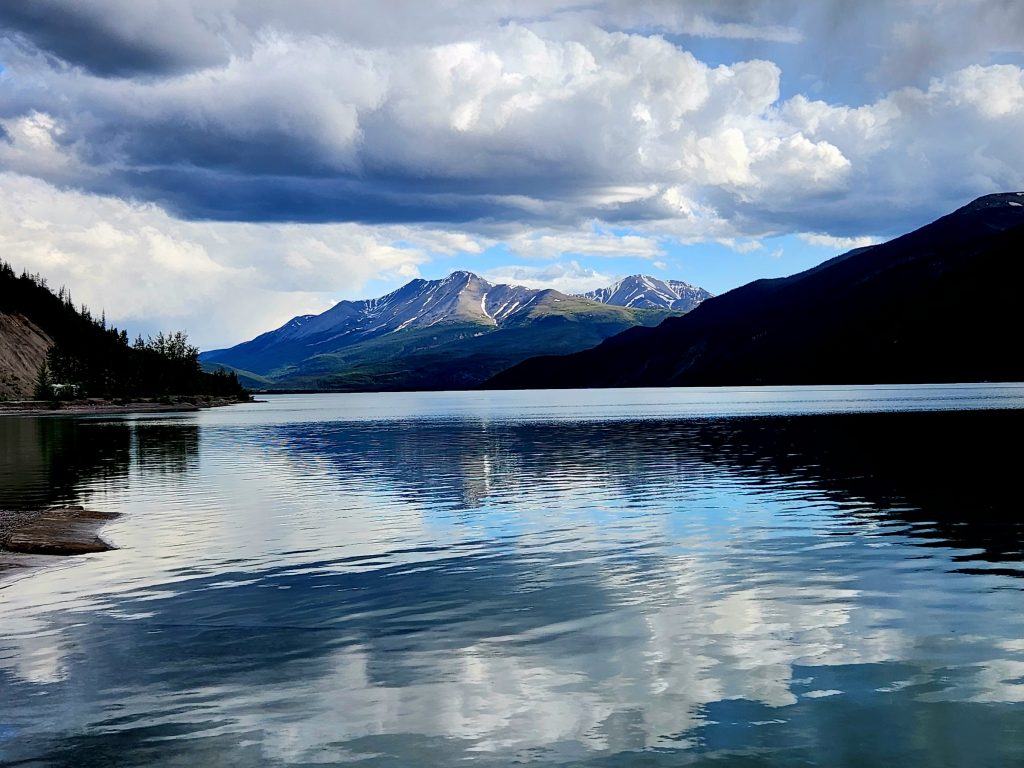
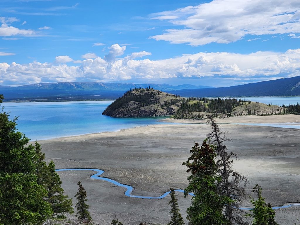
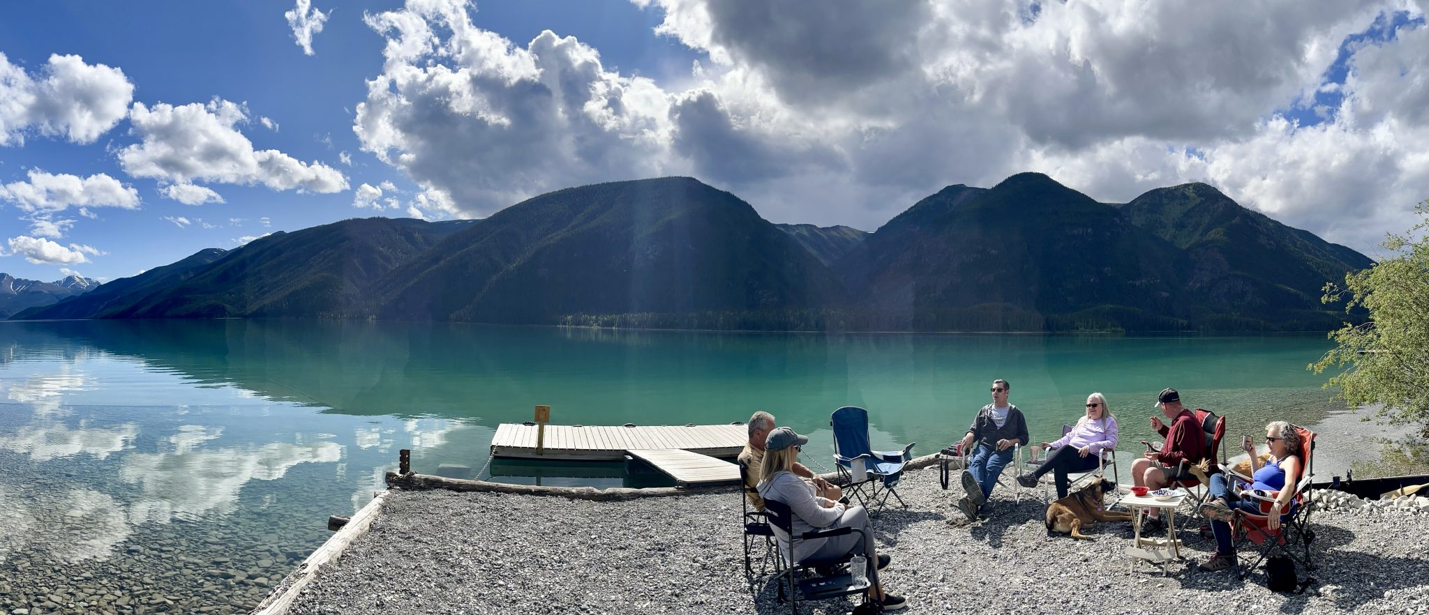
And even more beautiful was Muncho Lake itself, our destination and home for the next two nights. This jade green-colored lake is stunning in its mountain setting, and we enjoyed relaxing with our beautiful view. What makes the water look green? Two explanations I read: 1) copper oxide leaches from the bedrock underneath the lake; or 2) rock fragments scraped from glaciers are carried downstream to the lake. Take your pick😊.
After an excellent European-inspired dinner at the lodge restaurant where our campsites were located, we walked along the lake and enjoyed the light-filled evening (sunset at this time of year is about 10:30 at night!).
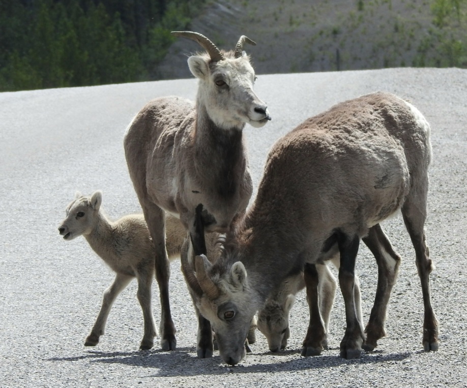
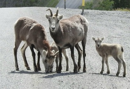
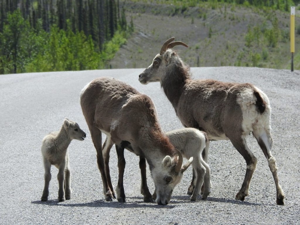
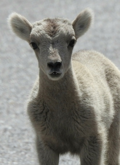
Day 15 Today was a rest day, so after a lazy morning, we headed out in cars to explore the area near Muncho Lake. We didn’t get far before four adult stone sheep and three babies (lambs) forced us to stop for a photo session. Wikipedia states that stone sheep are a type of thinhorn sheep “primarily found in Northern British Columbia [that] can often be seen licking minerals along the side of the Alaska Highway in areas such as Summit Lake, Stone Mountain Provincial Park, and Muncho Lake Provincial Park.” And that is exactly what these stone sheep were doing. I guess they read the article.
Stone sheep lick minerals along the roads.
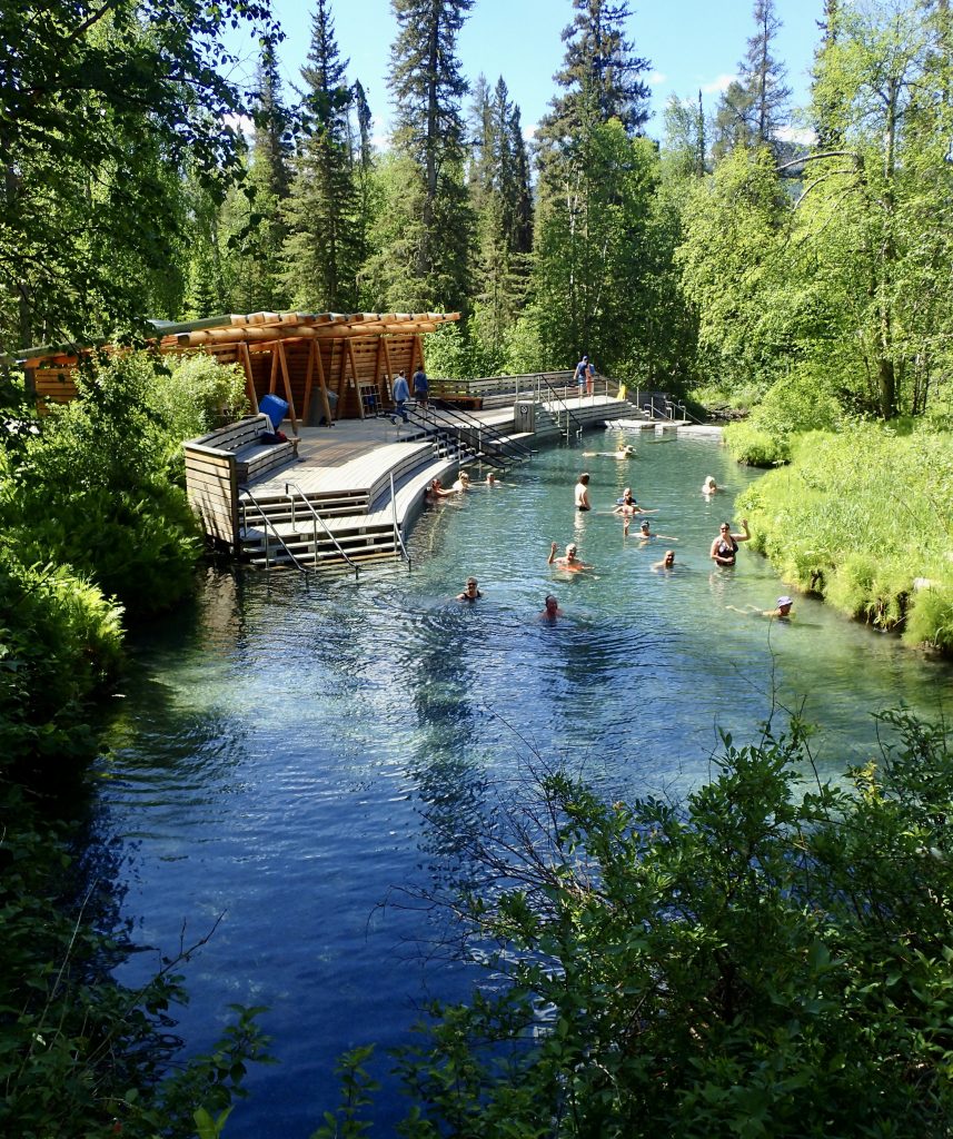
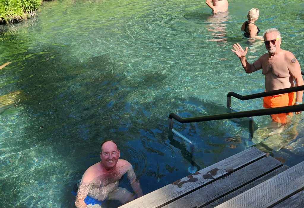
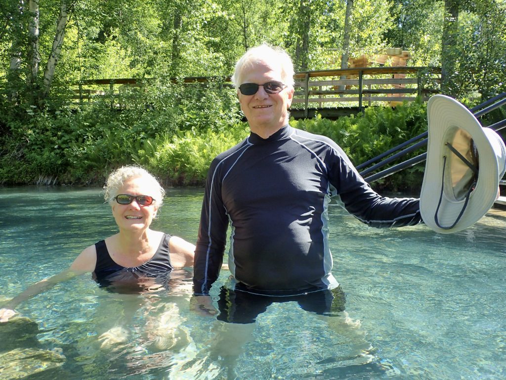
After many cute pictures, most of us headed north to the Liard River Hot Springs Provincial Park. While we are not fans of swimming-pool types of hot springs, the Liard River Hot Springs were in a natural setting that was picture perfect. We relaxed in the natural spring, testing out the various temperatures as cool runoff and HOT thermal-heated water entered the pool at various points.
One of the most beautiful hot springs we've ever seen!
Tom and Ron enjoy the Liard River Hot Springs.
The temperature ranged from cool to scorching.
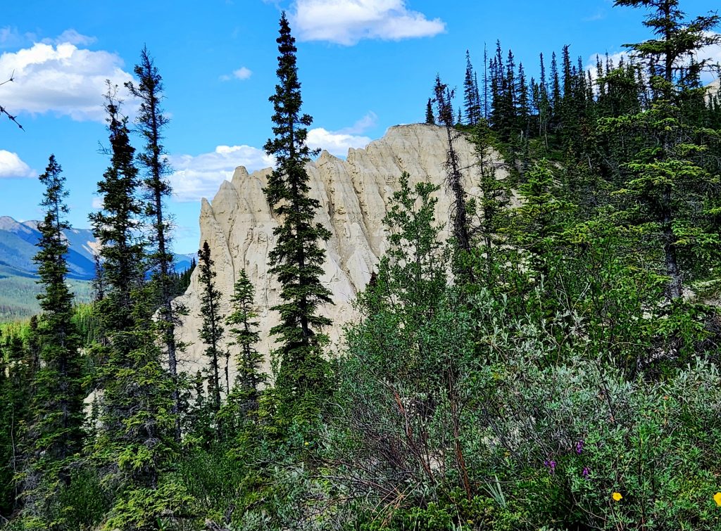
Hank and I then did a one-mile hike to another salt lick viewing area. This time we didn’t see any sheep, but it was a striking view of the Liard River and the surrounding mountains. And we encountered a few more stone sheep in the same spot along the highway as we headed back to our campground.
These cliffs have the minerals that the wildlife ingest.
Much easier to lick the road than climb those cliffs!
Is a stone sheep baby a "stone lamb"? Inquiring minds want to know.
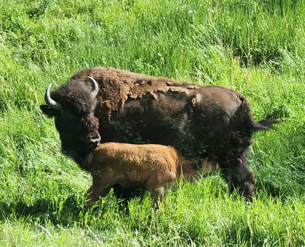
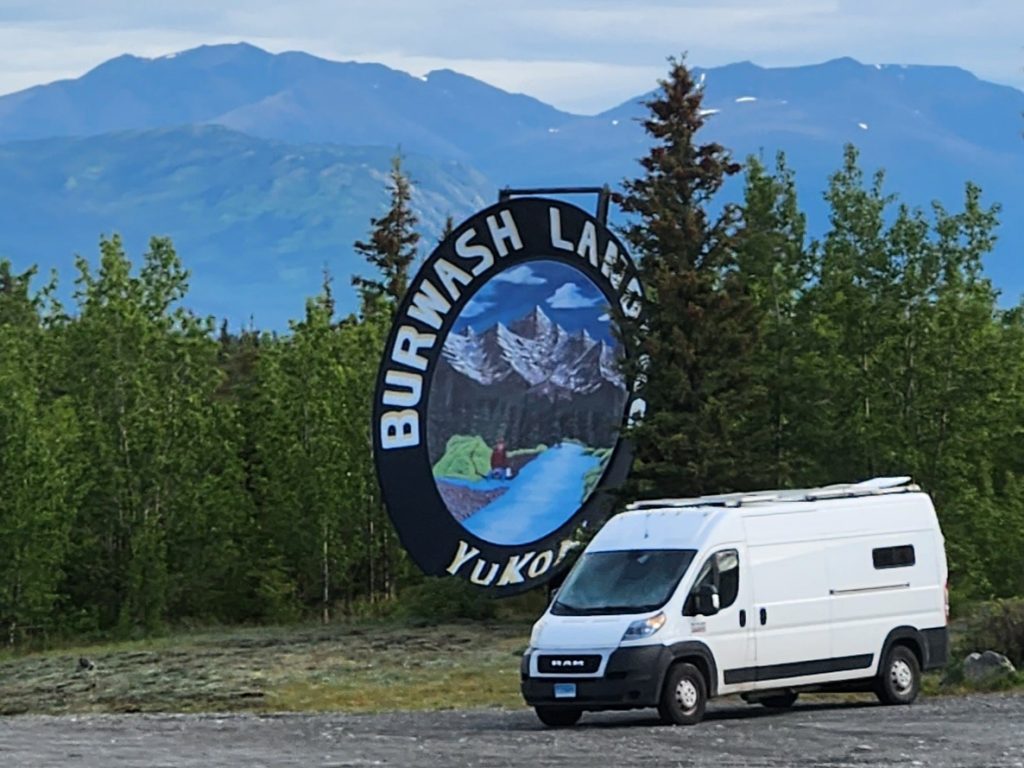
Day 16 Our journey from Muncho Lake, BC, to Watson Lake, Yukon Territory, was filled with wildlife sightings: a small caribou herd, two more stone sheep, a few dozen wood bison, including calves, and several more black bears!
Black bears were frequent along the highway today.
Wood bison are a different species from the bison we see in Yellowstone and other lower-48 states.
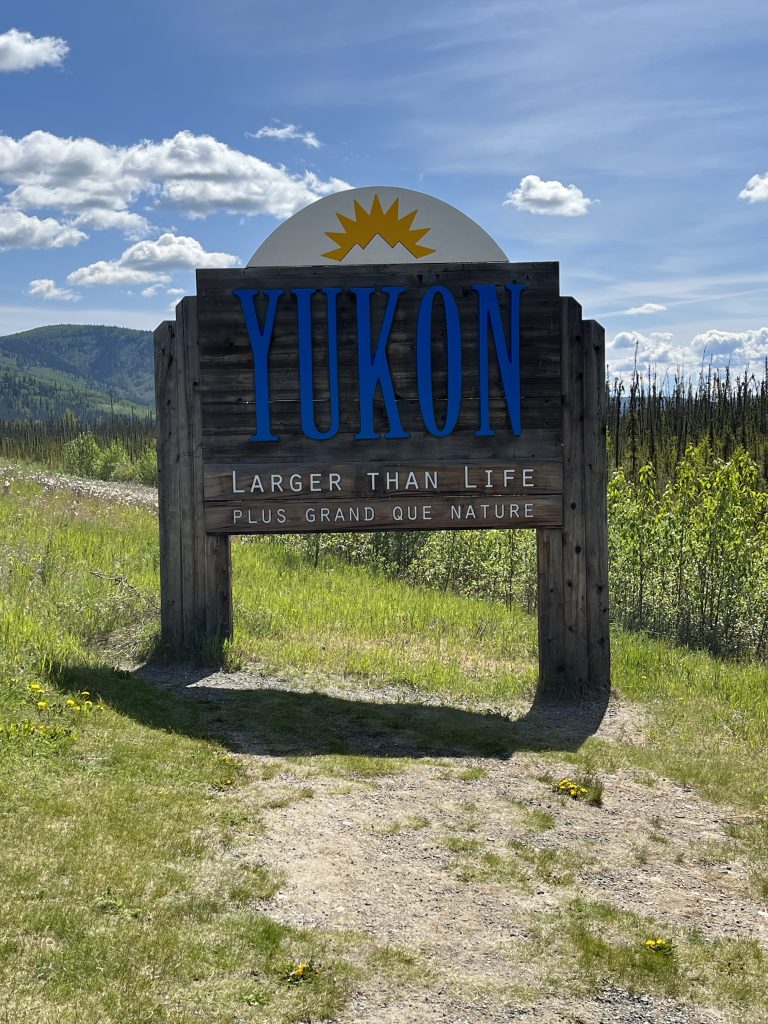
And we crossed into the Yukon Territory today, celebrating with multiple photos at the sign.
This sign wasn't at our first Yukon crossing, but it's prettier than the actual sign we encountered.
We made it to the Yukon Territory!
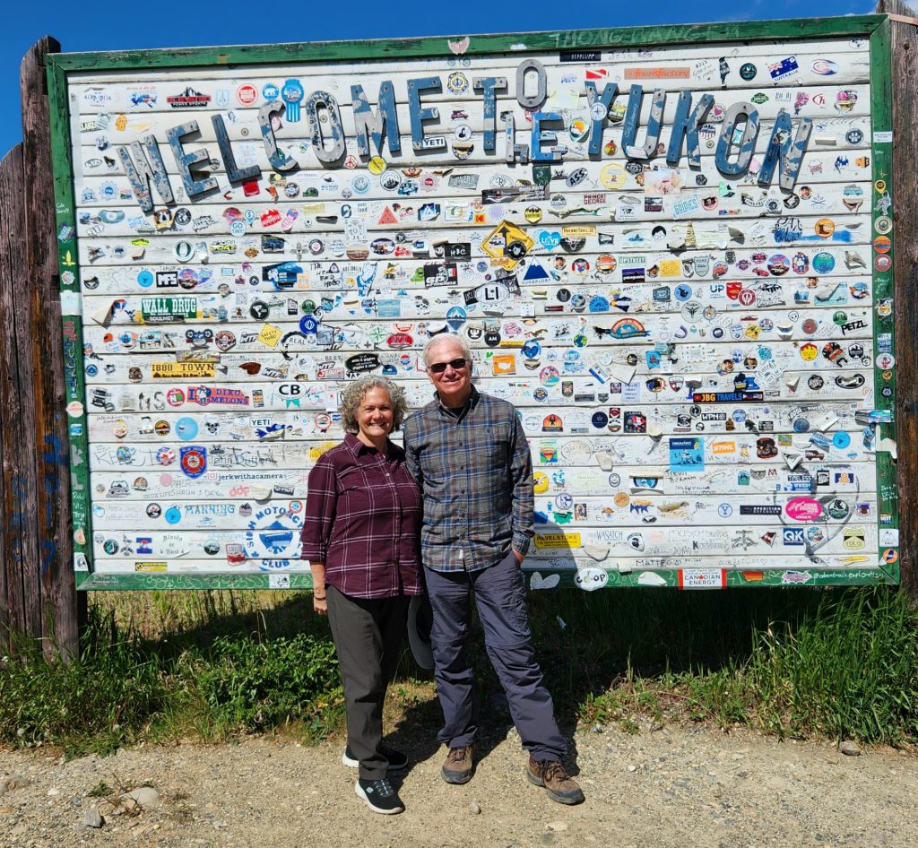
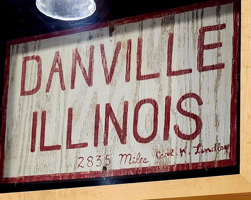
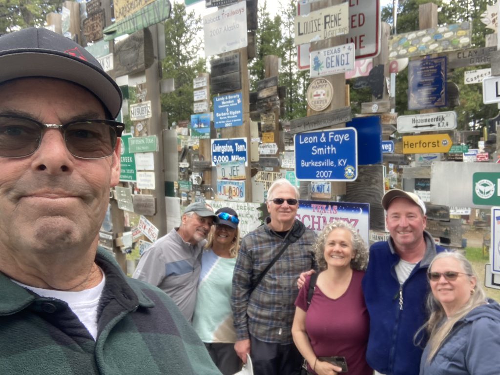
Once we arrived at our campground near Watson Lake and got set up, we headed back into town to the visitors’ center and the world-famous Signpost Forest. The Signpost Forest began when an American soldier working on the Alaska Highway was tasked with making road signs pointing to different locations, with indications of how far each location was (Whitehorse, 272 miles, Dawson Creek, 600 miles). Feeling a bit homesick, he also made a sign for “Danville, Illinois, 2,835 miles,” which was his hometown. He posted the sign and moved on to a new location. Little did he know that he had started a trend. Over time, individuals began to add their own signs, either indicating how far their home was from Watson Lake, or just putting up a sign taken from their hometown.
Carl Lindley's original sign disintegrated, but he made a new sign for the 50th anniversary of the highway.
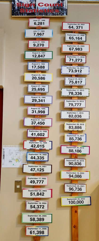
The number of signs added each year has increased dramatically.
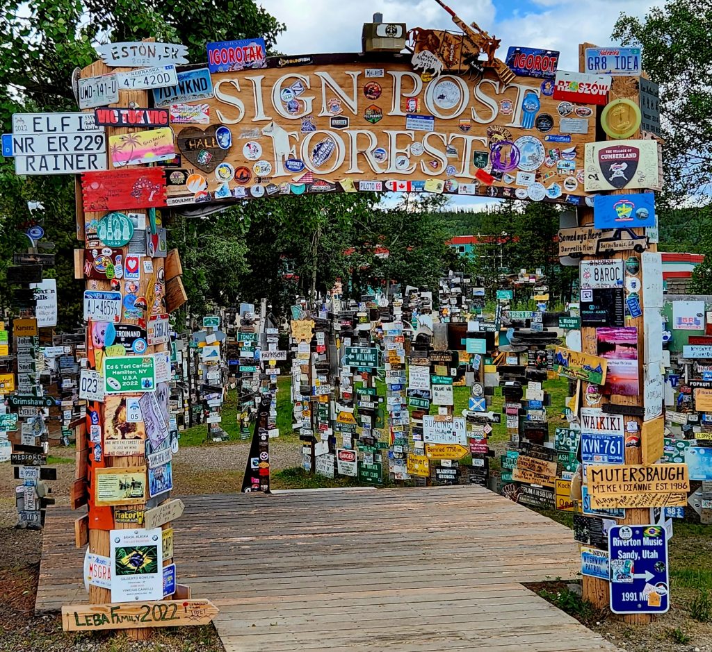
Last year, the signs numbered more than 100,000, and the city continues to put up new posts so that more and more signs can go up. They even provide hammers, nails, and screws to assist travelers.
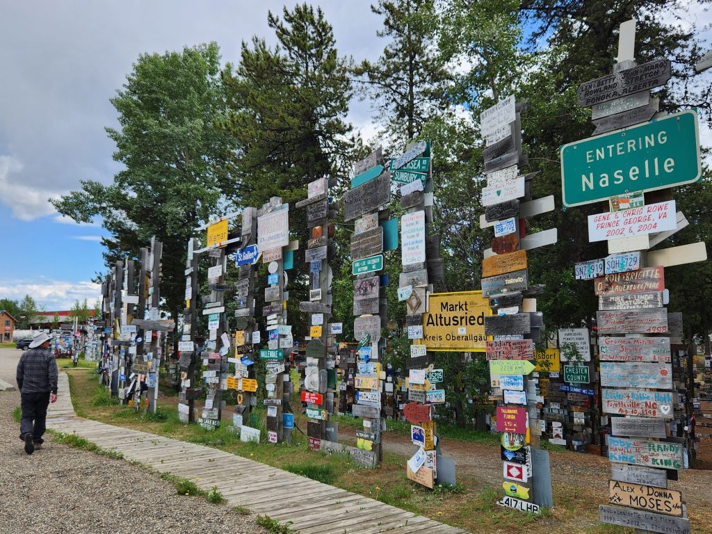
Pictures don't capture the scope of the Signpost Forest.
Hank walks past a newer section of the "forest."
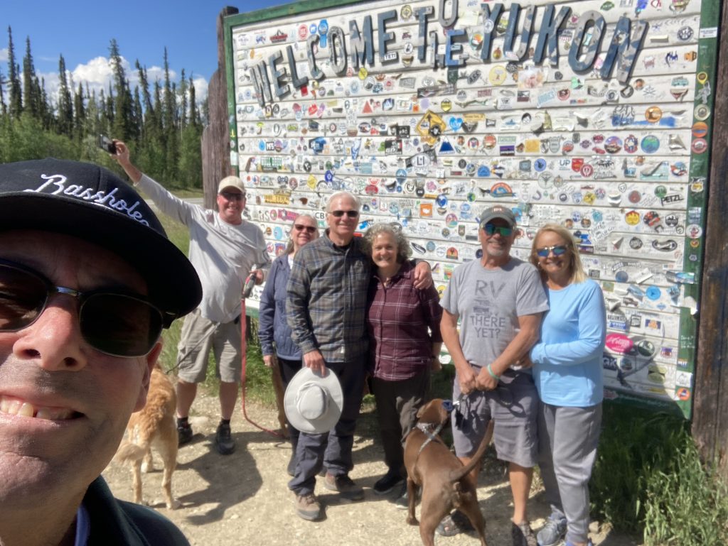
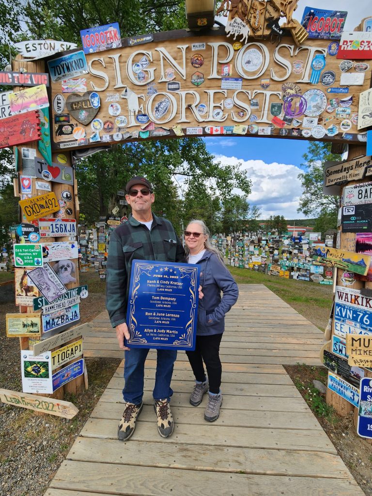
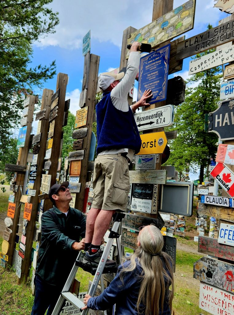
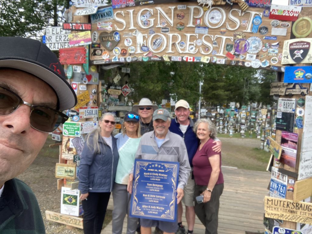
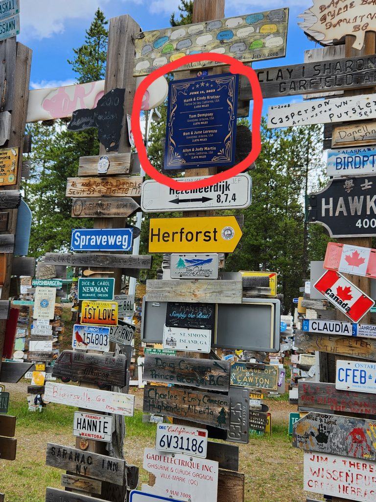
We had read about the Signpost Forest, and Judy and Allyn’s son Bryce has his own sign-making business. So, Allyn and Judy delegated this project to Bryce, who took charge of making a sign for our group, and none of the rest of us were allowed to see it until the big reveal in Watson Lake.
Judy and Allyn reveal Bryce's sign.
A close-up of the customized sign. Truly a marvel! Thank you, Bryce!
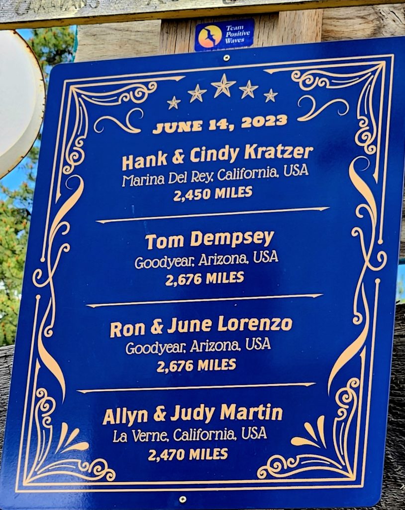
All we can say is, “THANK YOU, BRYCE, FOR MAKING OUR DREAM A REALITY AND FOR EXCEEDING OUR WILDEST EXPECTATIONS!!!!”Our names, hometowns, distances, and even the exact date we visited the Signpost Forest are recorded on Bryce’s beautiful and unique sign that now sits proudly among the thousands of other signs people have contributed. What a special event to mark our journey on the Alaska Highway!
Tom screws the sign into place.
Standing beneath our sign.
Before the sign went up.
Our sign stands out from the rest!
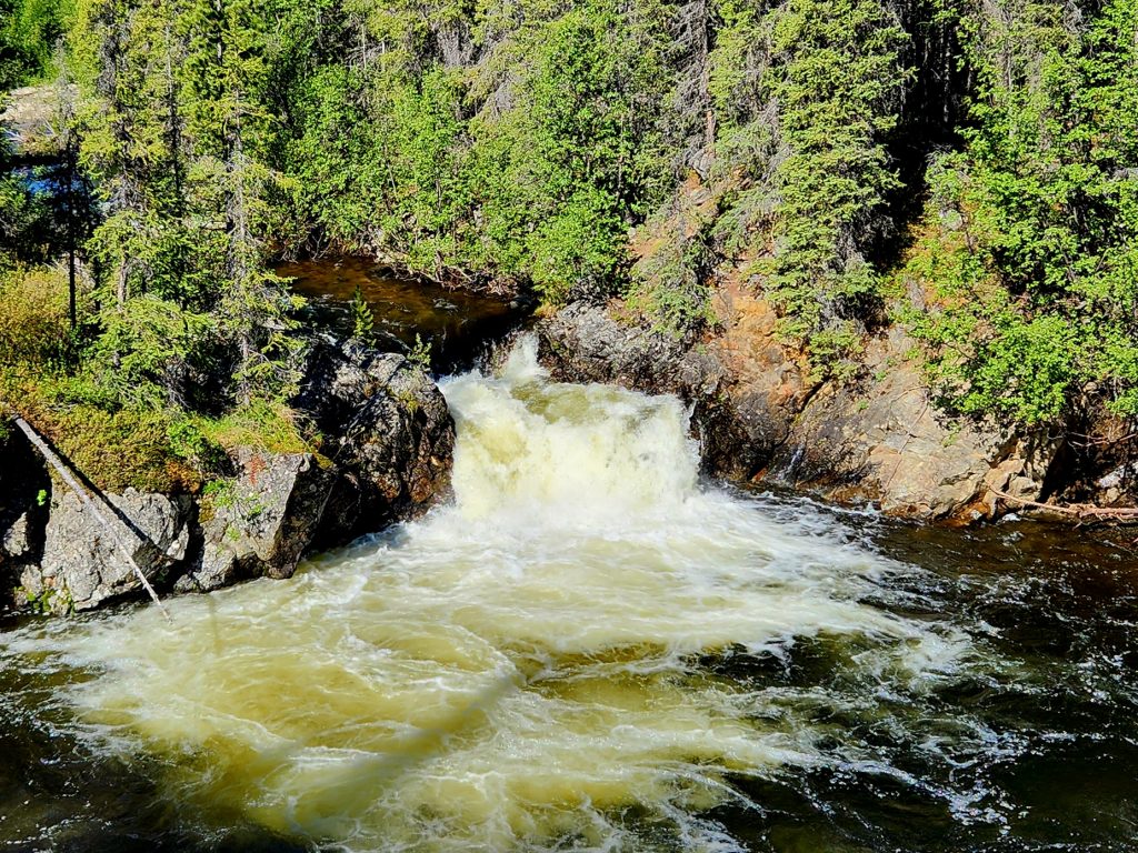
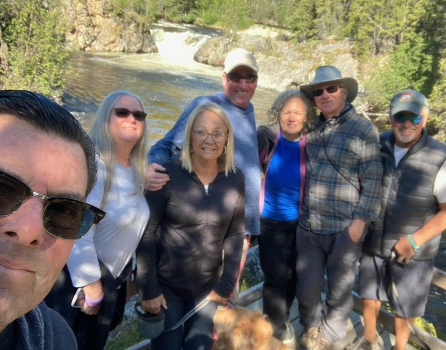
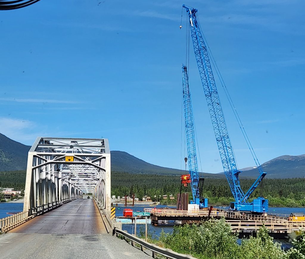
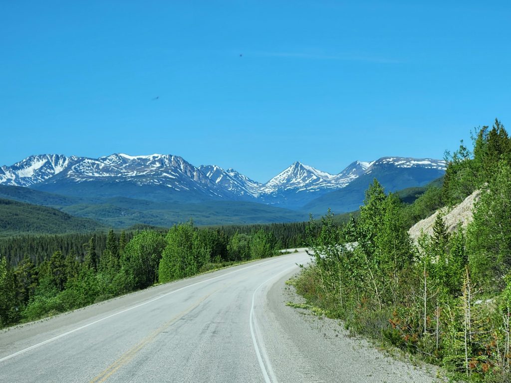
Day 17 Today’s travel day in the Yukon Territory from Watson Lake to Whitehorse was gorgeous. We didn’t see quite as much wildlife (just a few moose), but the mountain scenery around us for much of the drive was stunning. We stopped for a brief walk at the Rancheria Falls Recreation Site, enjoying twin waterfalls at the end of the boardwalk (and meeting two bicyclists traveling from Alaska all the way to Argentina!). We enjoyed lunch at the Nisutlin Bay Bridge in the Tlingit town of Teslin.
Enjoying a break from the drive at the Rancheria Falls
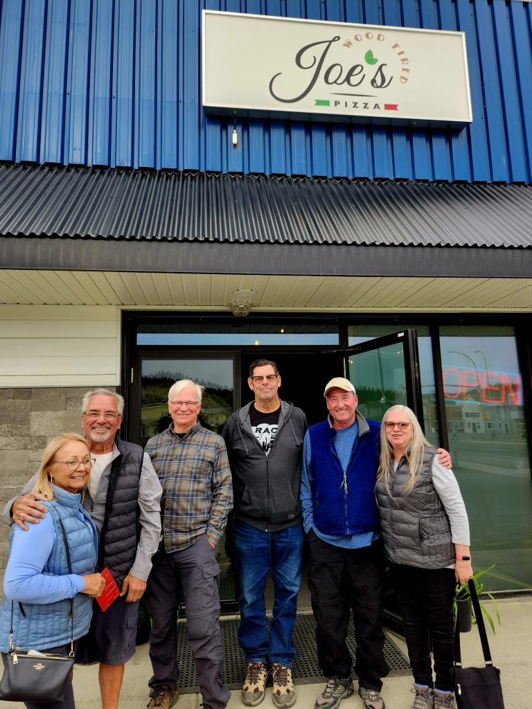
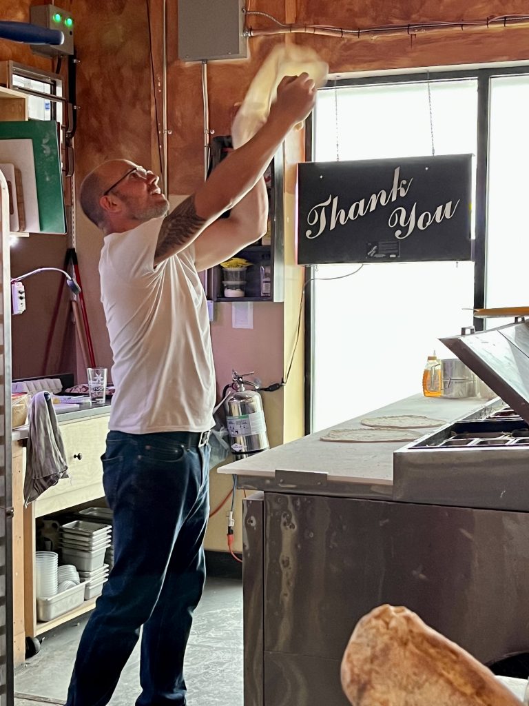
And once we made it to Whitehorse, we enjoyed a fantastic pizza dinner at Joe’s Wood-Fired Barbecue. However, we did not stay up for the sunset at 11:30 p.m.!
Joe flips the pizza dough for amazing pizza!
Day 18 We had a catch-up and exploration day in Whitehorse today. Some did laundry and shopping; others a bit of sightseeing and hiking. Everyone in our group has experienced a challenge on the trip thus far: two RVs have gotten flooded, one RV locked out its residents, one RV had an air conditioner go on the fritz, one car got a chipped windshield…But we’ve all survived and overcome these obstacles. We hope this is the worst we encounter on our 80-day journey.
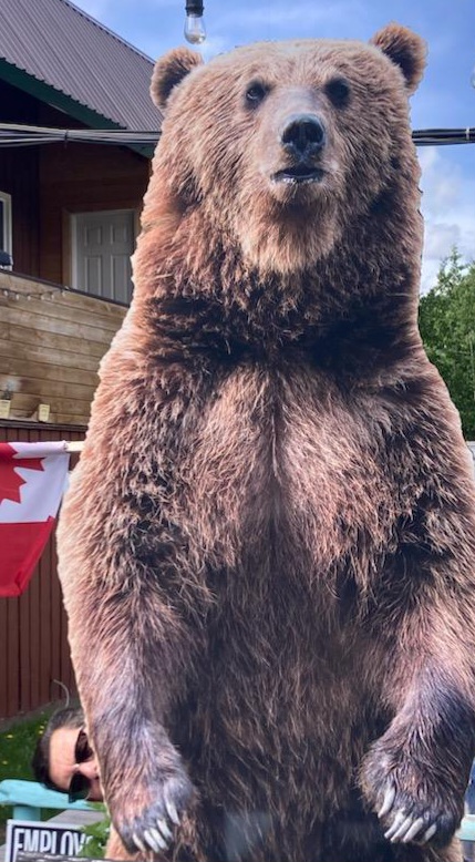
Judy and Allyn imagined what it would be like to encounter a grizzly bear.
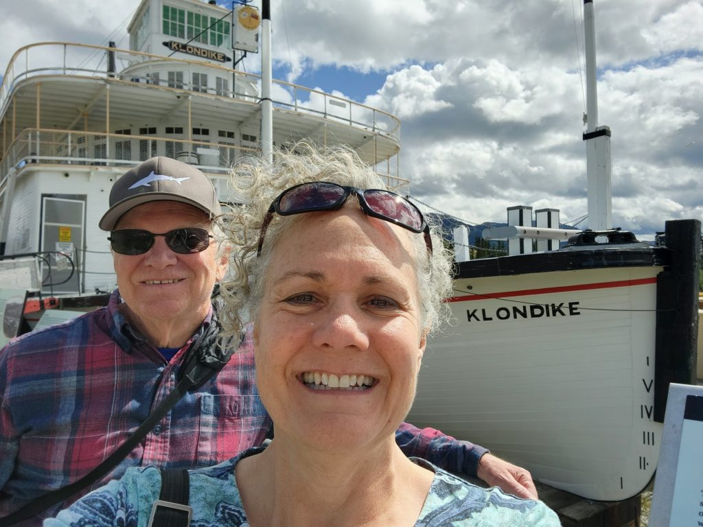
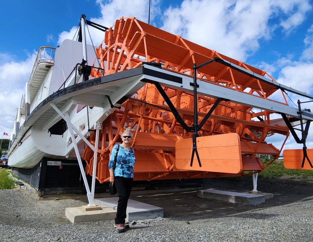
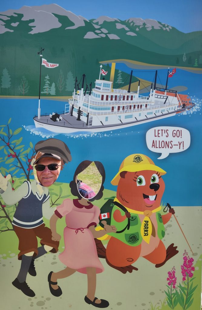
Hank and I stopped at two iconic sights in Whitehorse—the SS Klondike and the Yukon Transportation Museum. The SS Klondike was a stern-wheeler on the Yukon River that was built in 1929 and rebuilt in 1937. It carried mail, supplies, passengers and silver lead ore between Whitehorse and Dawson City (ground zero for the Klondike Gold Rush).
Where's Allyn?
The sternwheel on the SS Klondike
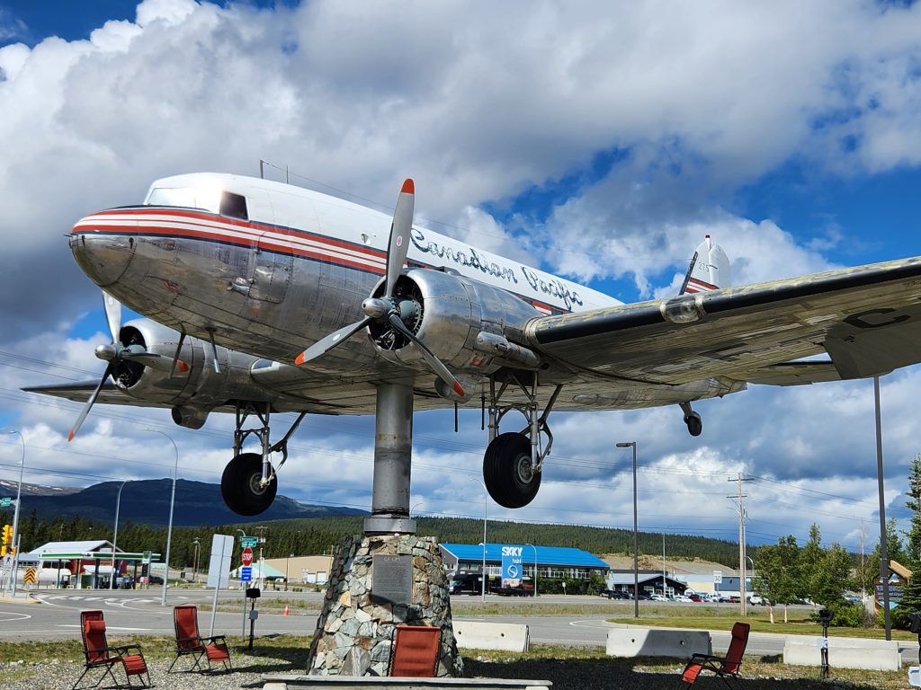
The Yukon Transportation Museum hosts the world’s largest windvane. A Douglas DC-3 (originally a C-47) that flew during and after World War II was grounded in 1970 and restored in 1981, when it was mounted on a rotating pedestal. It literally moves according to the direction of the wind, pointing its nose into the wind.
The world's largest windvane, a DC-3, spins on a pedestal.
Where's Allyn? Or, where's Hank?
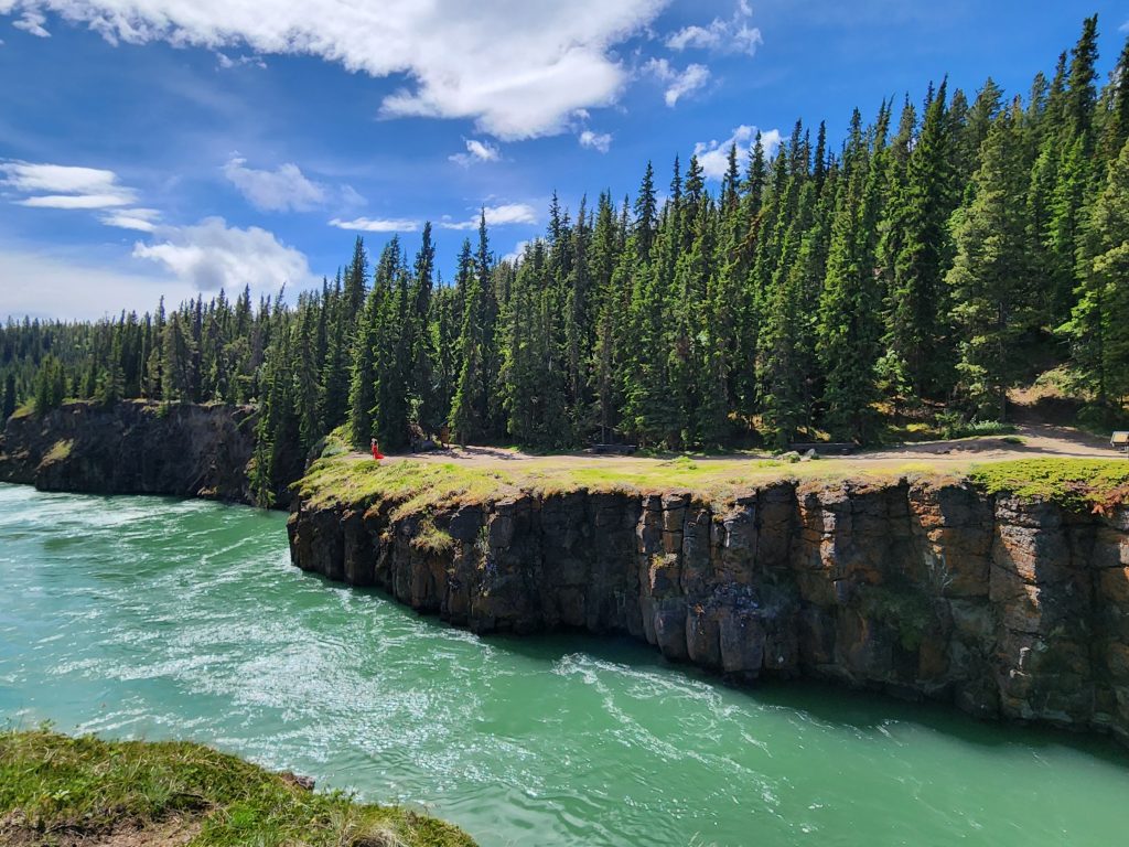
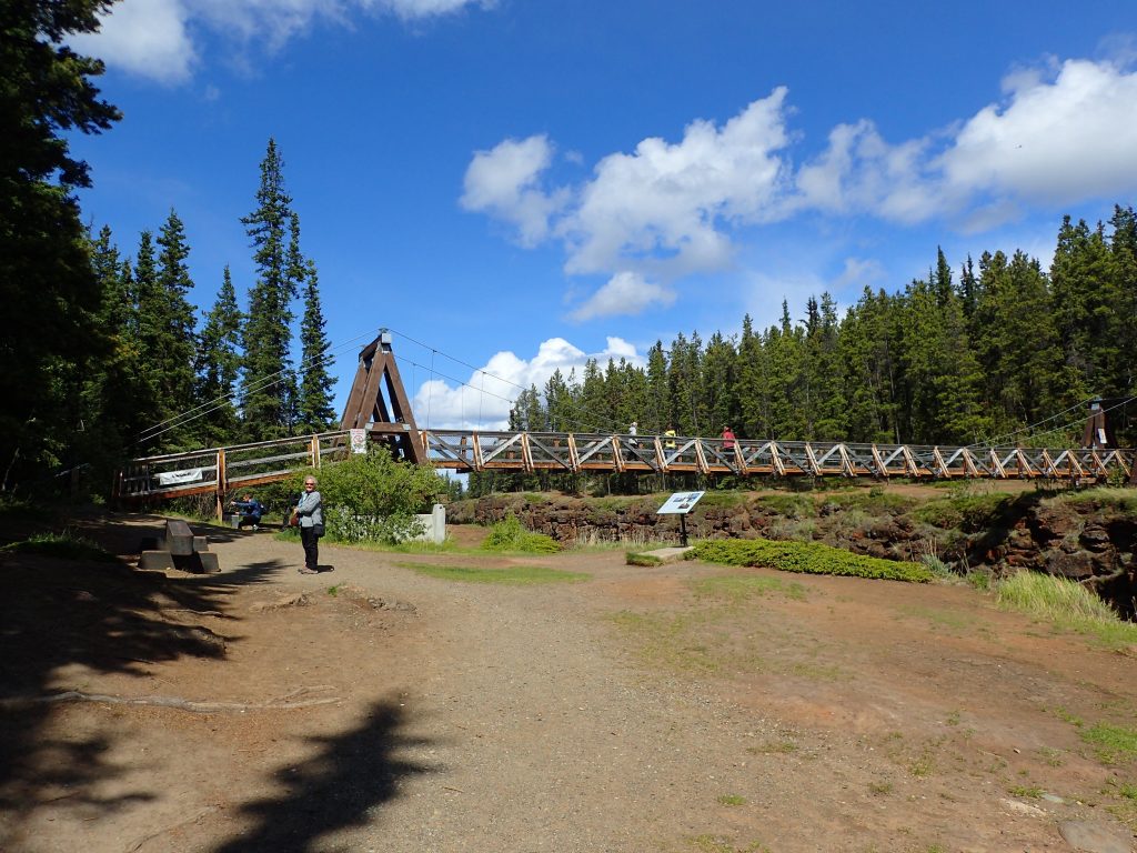
Our favorite sight in Whitehorse was Miles Canyon, 2 miles south of town on the Yukon River. A short walk leads to a suspension bridge over the river with glorious sights of the canyon. The Yukon Conservation Society offers free guided hikes twice a day in the summer, and we enjoyed the knowledge and leading of Andrew, a college student who grew up in Whitehorse, and Daniel, a graduate student who relocated here from Iran, Malaysia and other parts of Canada, as we explored the 2 ½-mile Canyon City Trail.
A view of Miles Canyon from the bridge
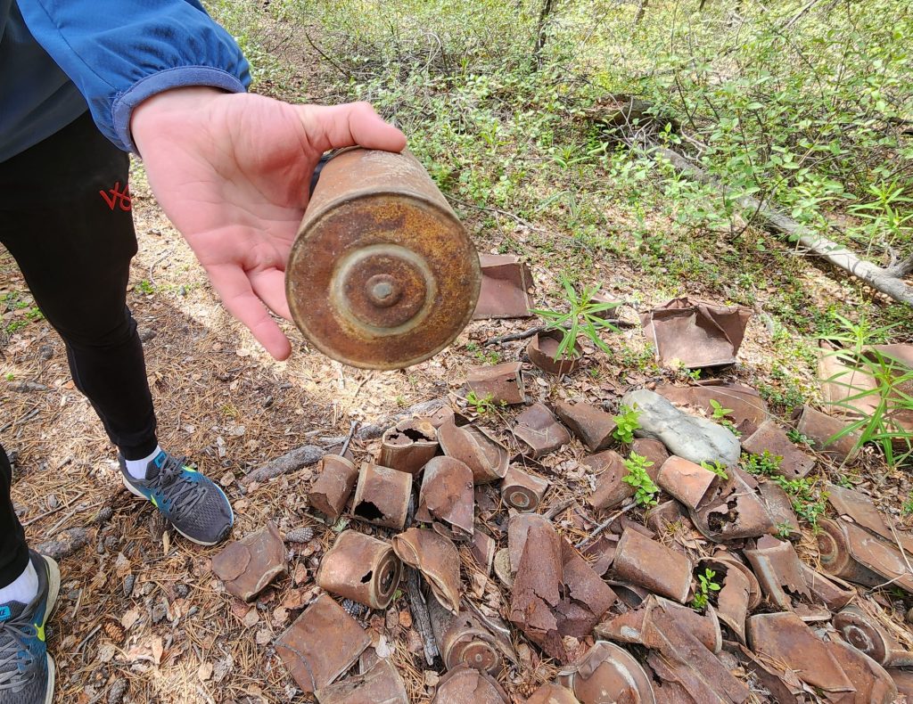
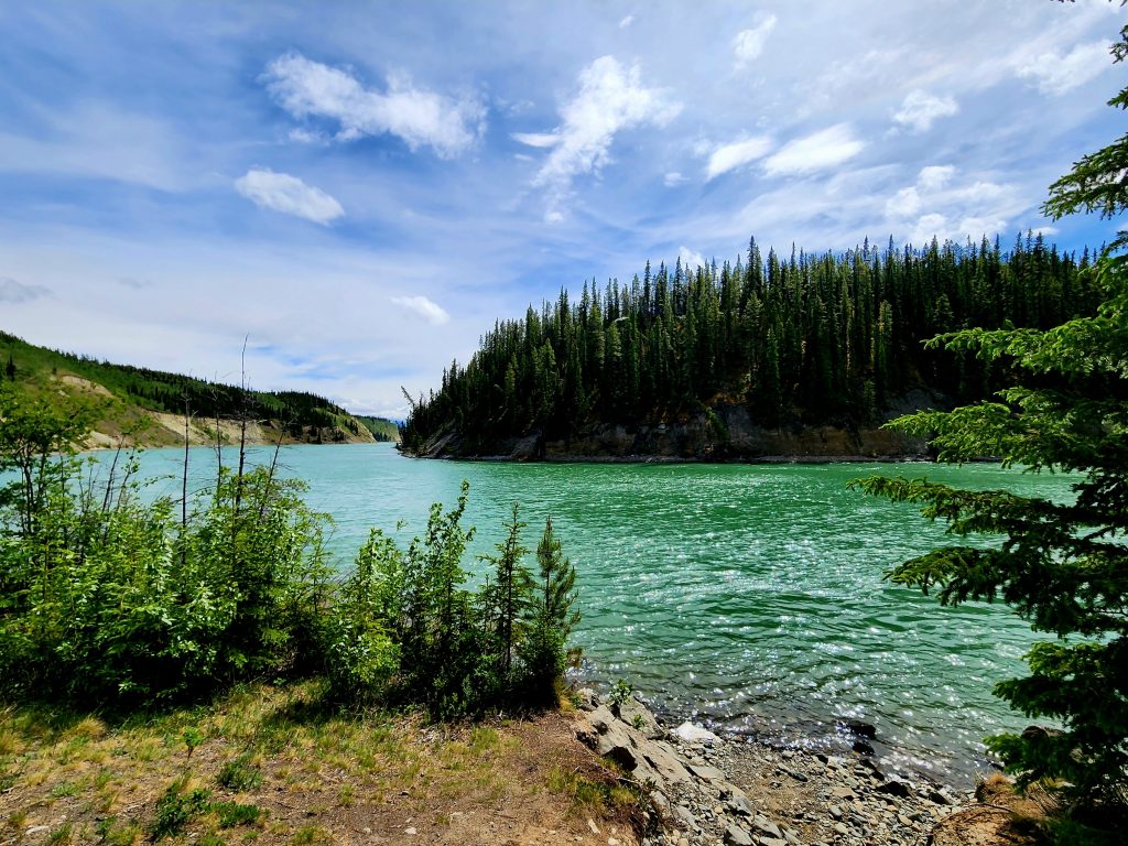
During the Klondike Gold Rush, miners would depart from Skagway, haul a year’s worth of supplies up and over Chilkoot Pass, build boats to travel through several lakes and onto the Yukon River, and then try to survive the rapids of Miles Canyon. While a dam upstream has eliminated the rapids, the canyon is absolutely gorgeous, especially when the sun shines on the green, glacial-fed water. Hank and I learned about many of the plants and trees in the area, and about the history of Canyon City, which sprung up along the canyon to service all the miners coming through. They still have old tin cans and other miner trash from the Gold Rush of the late 1800s.
A tin can with a lead bottom left over from the Klondike Gold Rush in the late 1800s.
The suspension bridge over Miiles Canyon
The ruins of Canyon City look out on this stunning bend in the Yukon River.
Miles Canyon is gorgeous!
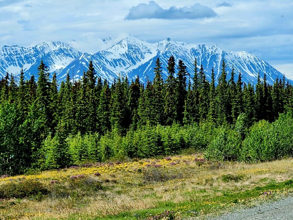
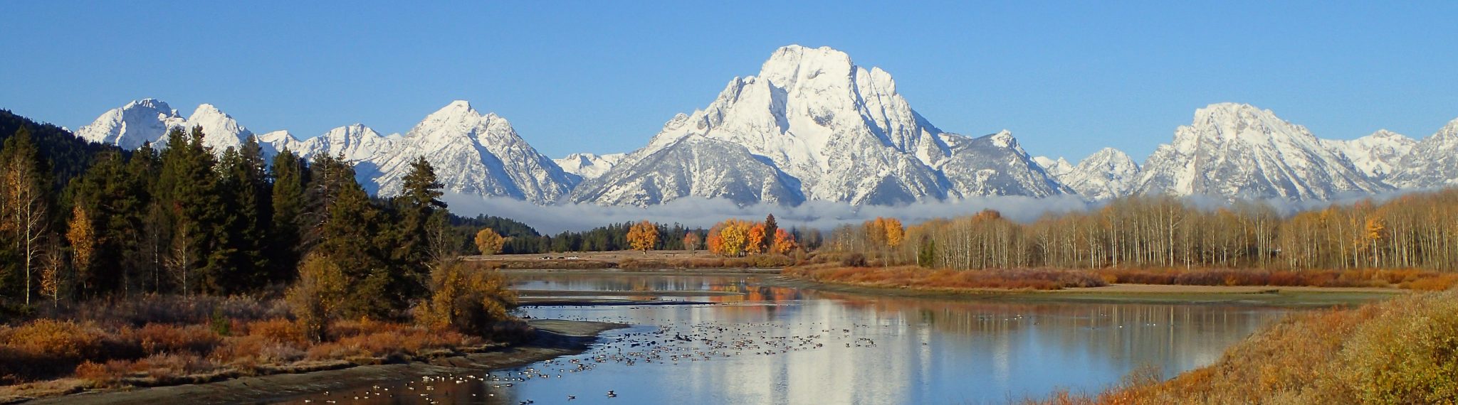
Day 19 What a glorious day of driving from Whitehorse to the Congdon Creek Provincial Campground on Kluane Lake near Destruction Bay, Yukon Territory! Not much wildlife (a red fox was a wonderful early sighting). But the mountains kept getting bigger and closer and the wildflowers got brighter and thicker.
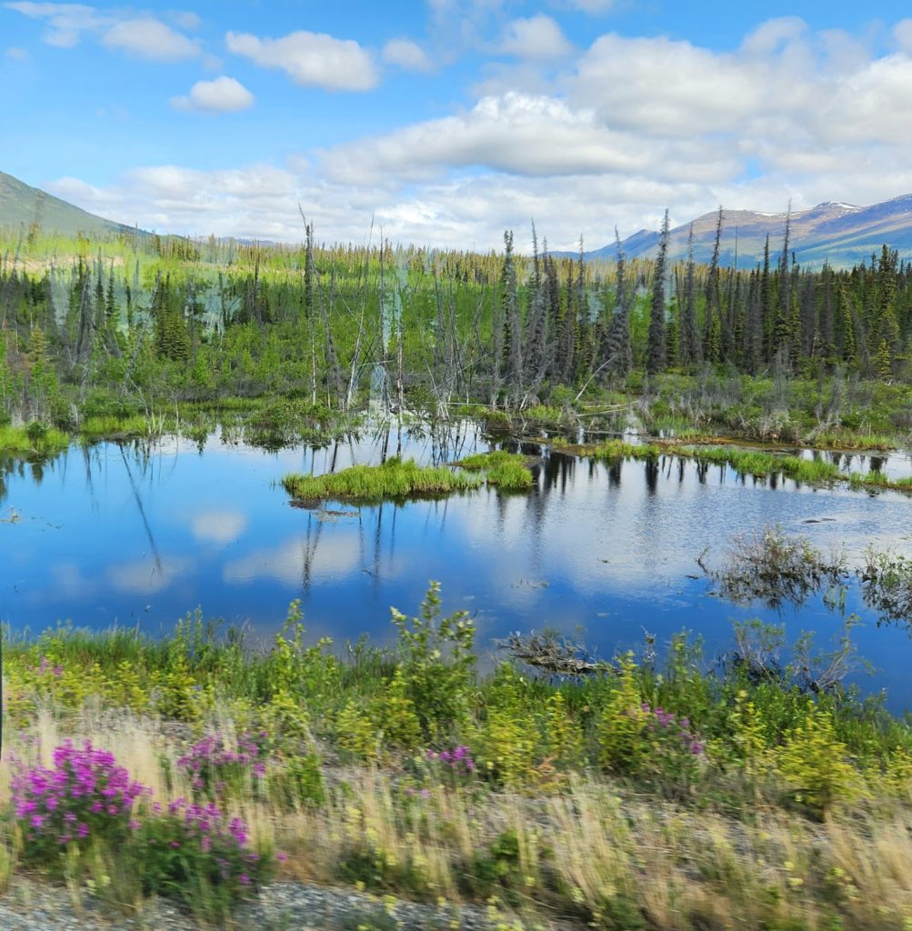
We stopped at the Kluane National Park Visitors’ Center in Haines Junction and enjoyed a short movie about the park and its people. Several First Nations bands have lived in this area for millennia, and there is an abundant supply of wildlife and plants for their use.
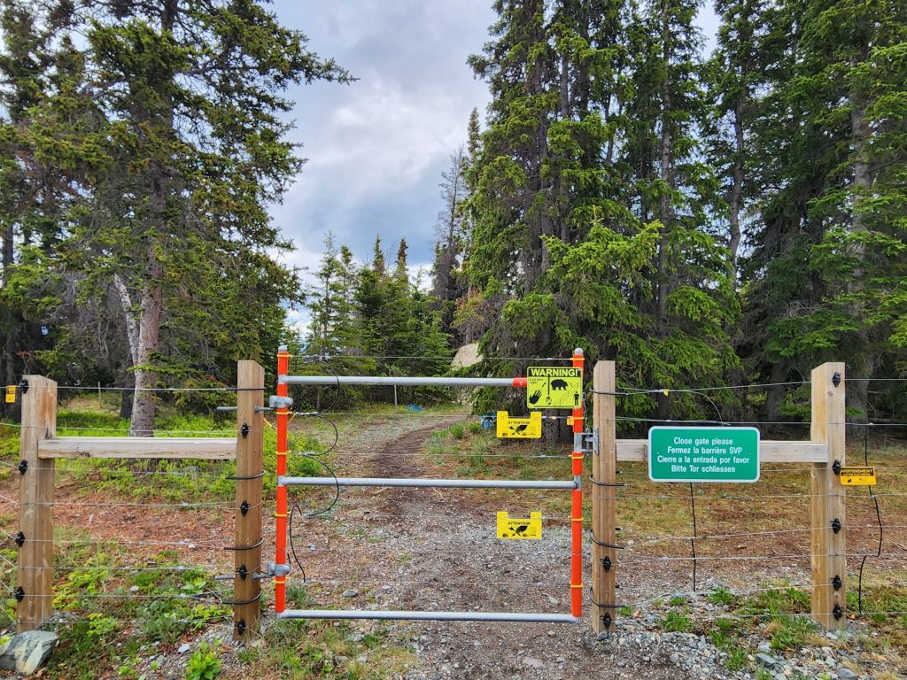
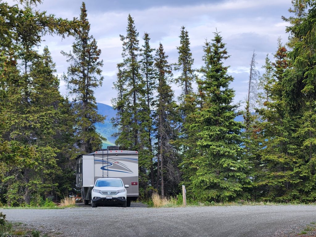
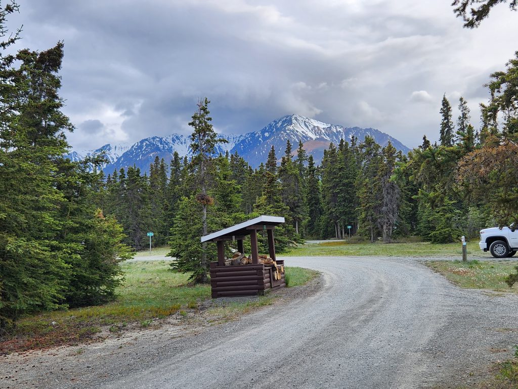
We headed another hour to our first campground without reservations, which is always a little nerve-wracking, especially when looking for four campsites. Not to worry—there were plenty of sites and most of us had a view of the enormous Kluane Lake and the stunning Kluane Range. The area is prime grizzly habitat, so the tent campers are inside an electric fence!
Where's Allyn? Where's Hank?
Tent campers are surrounded by an electric fence, but we didn't see any grizzlies.
Our campsite at Congdon Creek Provincial Park--beautiful views in all directions.
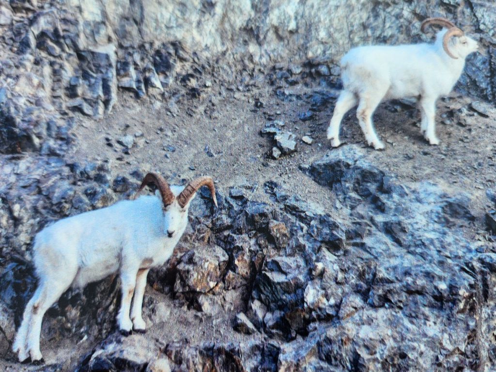
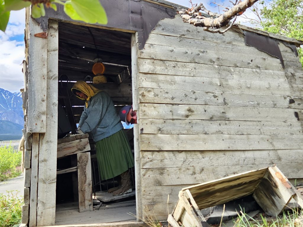
Day 20 A much-needed rest day, as the roads have been getting rougher as we head north and west. We explored the Visitor Center for Kluane National Park, Thechal Dhal (sheep mountain), and an old cabin where a guy sold goods to miners on the original Alaska Highway. They have spotting scopes set up at the visitor center, but no Dall sheep were in sight. They’ve already headed to higher ground (a week ago they were seeing 20-30 per day ☹).
We didn't see these Dall sheep because they recently moved to higher ground.
We did see this old cabin with a mannekin working on a Dell computer! Where's Allyn?
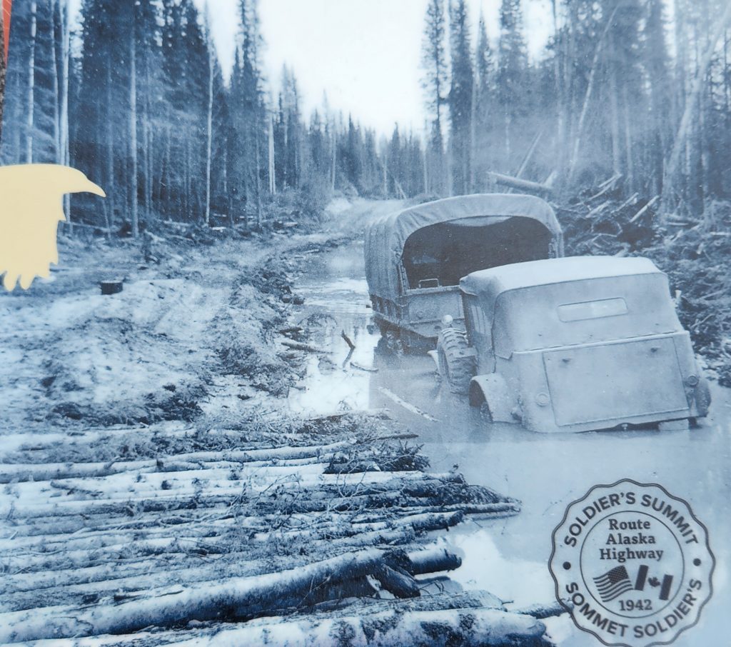
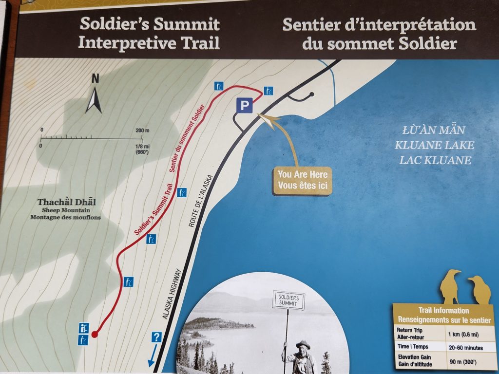
We hiked the short, steep 0.6-mile Soldiers’ Summit Trail to an overlook where a ceremony was held on November 20, 1942, to mark the opening of the Alaska Highway.
The view of Kluane Lake from Soldier's Summit was terrific! A receding glacier has changed its melt pattern, so the lake no longer receives spring meltwater from the glacier.
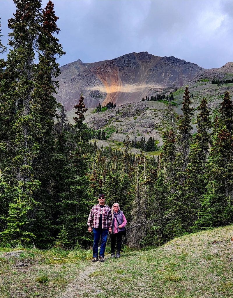
Judy and Allyn on the Soldiers' Summit Trail
The site of the Soldiers' Summit, the official opening of the Alaska Highway!
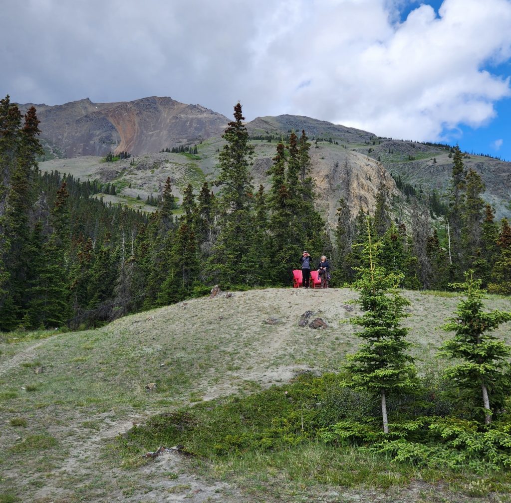
We sat in the adirondack chairs to enjoy the view from Soldiers' Summit.
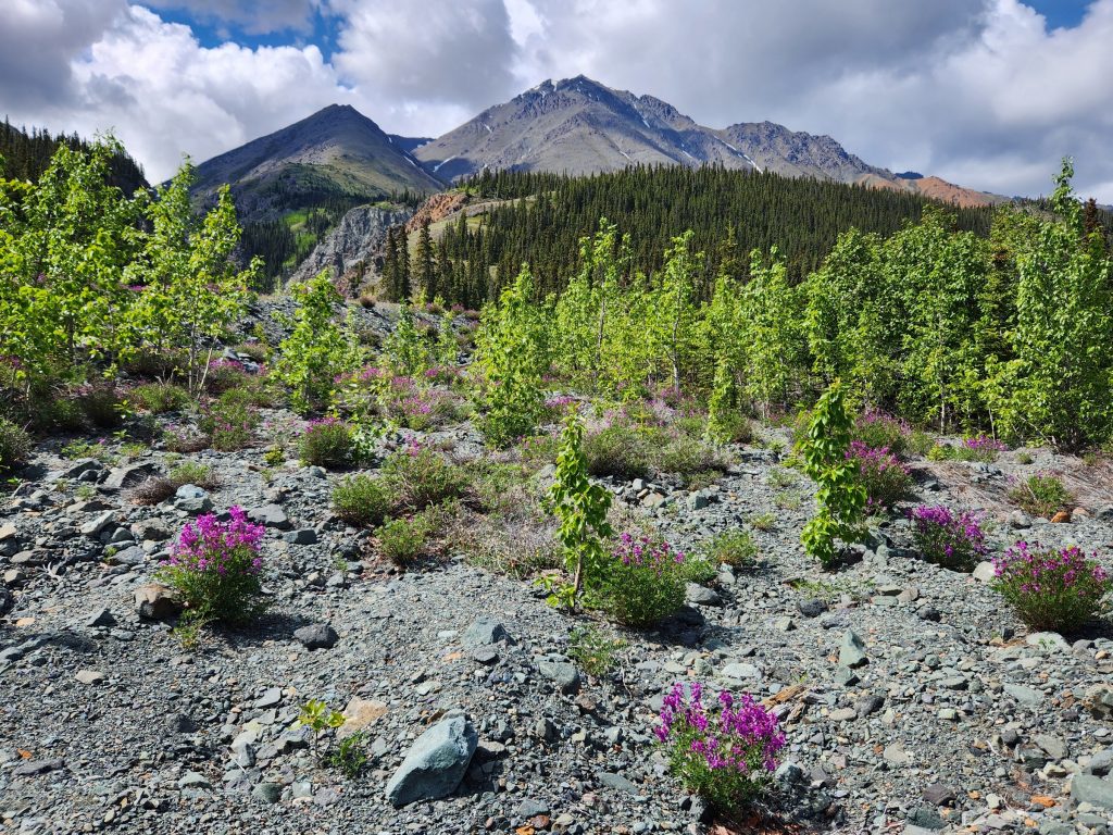
And since we were in Allyn and Judy’s jeep, Allyn drove us along a couple of gravel roads with gorgeous views of the lake, the mountains, the cottonwood trees, and the wildflowers (Arctic lupine and fireweed were the most stunning). We also just enjoyed the beautiful scenery near our campground. While we four were at Soldiers’ Summit, Ron, June, and Tom were searching for Chaco (Ron and June’s dog) who had run away. They eventually found her, to everyone’s great relief!
A spot off a gravel road as we explored the area around Kluane Lake in the Yukon
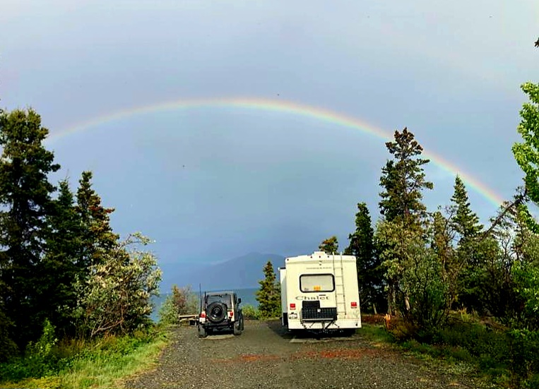
Judy and Allyn had a beautiful rainbow over their campsite.
The view from our campsite
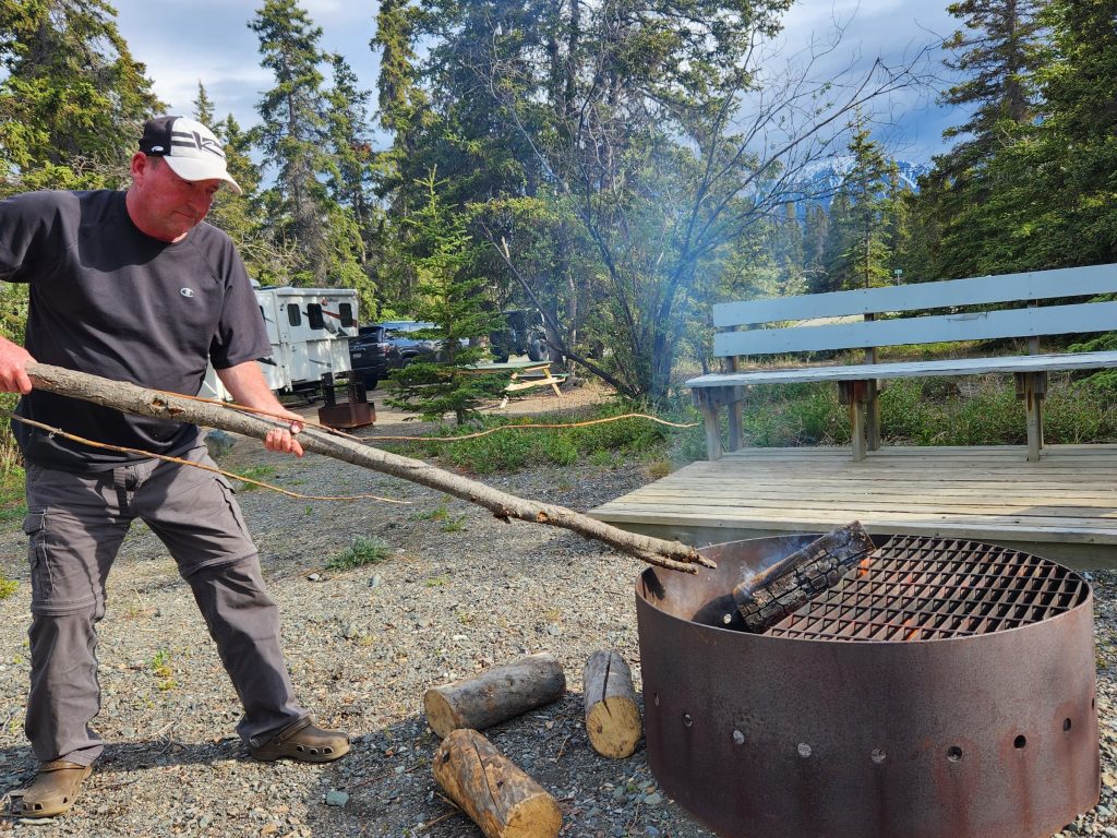
Tom at work on the campfire
Ron and June had a great view of the lake at their campsite.
Day 21 This was our marathon driving day! It was “only 235 miles” from our campground at Kluane Lake to Tok, Alaska. But while it was beautiful, it was also very challenging. We knew there would be lots of potholes and frost heaves (uneven pavement from the permafrost thawing underneath). We knew there might be road construction because both the Yukon Territory and Alaska have such a short time when they can work on their roads. And yes, we found all of those conditions. There were multiple miles when we crawled over washboard or dodged potholes, or followed behind a pilot car on gravel, resulting in over 8 hours to drive 235 miles.
Frost heaves in the pavement because the permafrost under the asphalt thaws and refreezes, causing the road to buckle.
Sometimes the potholes and frost heaves are marked with flags or signs, but not always.
However, it wasn’t all bad. There were some beautiful sights along the way as we crossed from Canada back into the U.S.
And who wouldn’t want to see the world’s largest gold pan (disguised as a community sign)?
Not a bad view for driver Hank
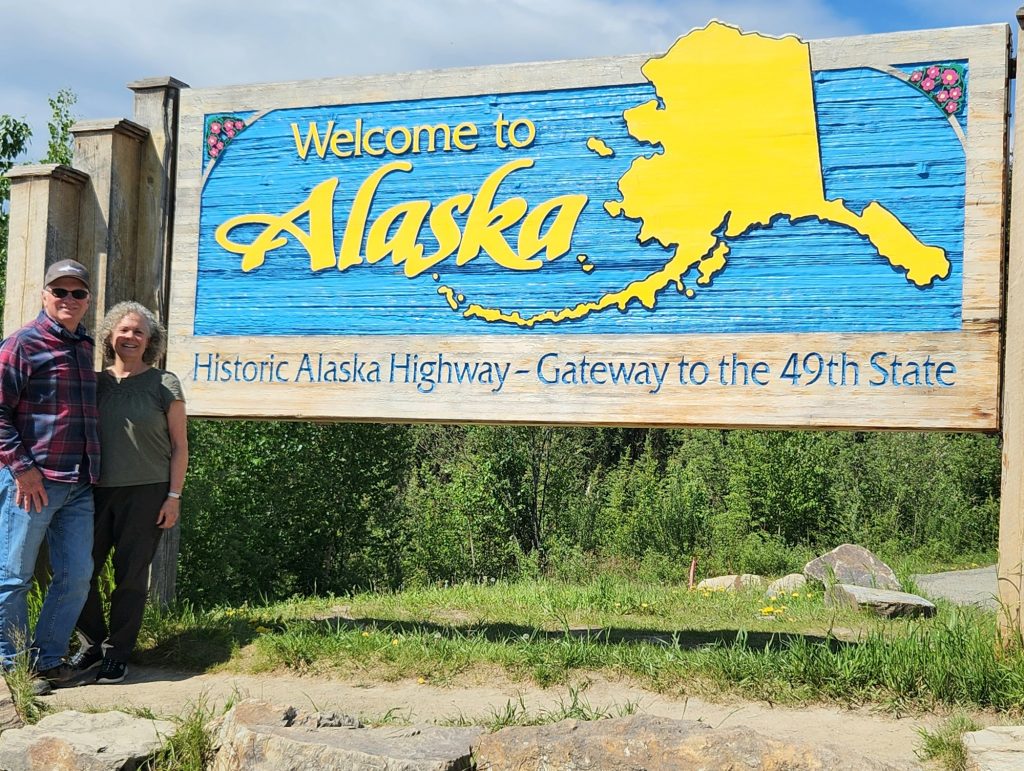
And we survived the road! We made it to Alaska!
Hank and Cindy (Danno and Leilani stayed in the RV)
Tom, Luna and Blazer
Ron, June and Chaco
Judy and Allyn
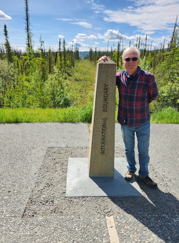
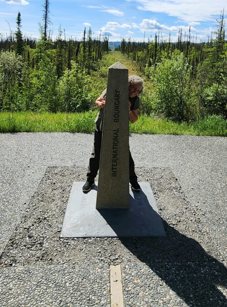
Hank is on the U.S. side, but his hand is in Canada.
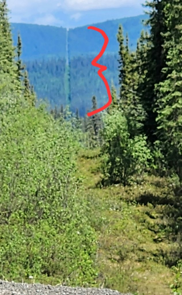
Notice the boundary all the way up the hill where the trees have been cut down to show the actual border between the U.S. and Canada.
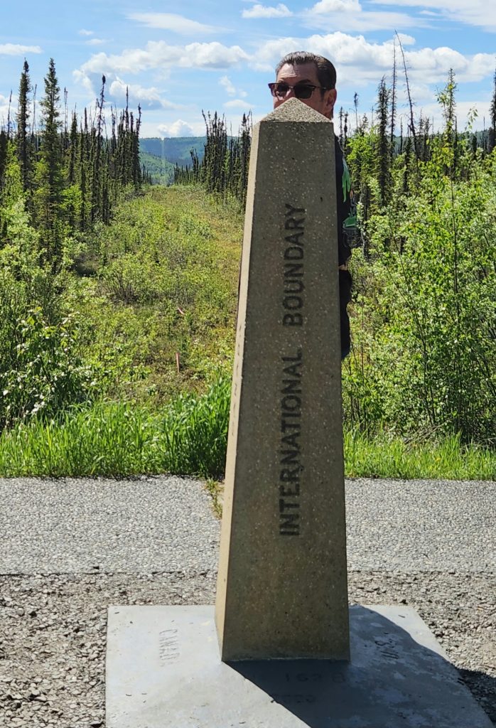
I'm standing in two countries simultaneously.
Where's Allyn? Which country is he in?
And we made it to Tok and our first campground in Alaska! Yay! Phase 2 of our trip is complete. Sunset is at 11:49 p.m. tonight and sunrise at 3:17 a.m.! Our longest phase, our five weeks in Alaska, begins now. The next blog post will be about The Alaskan Interior (Tok, Chicken, & Wrangell-St. Elias National Park). Thanks for joining us on the journey.
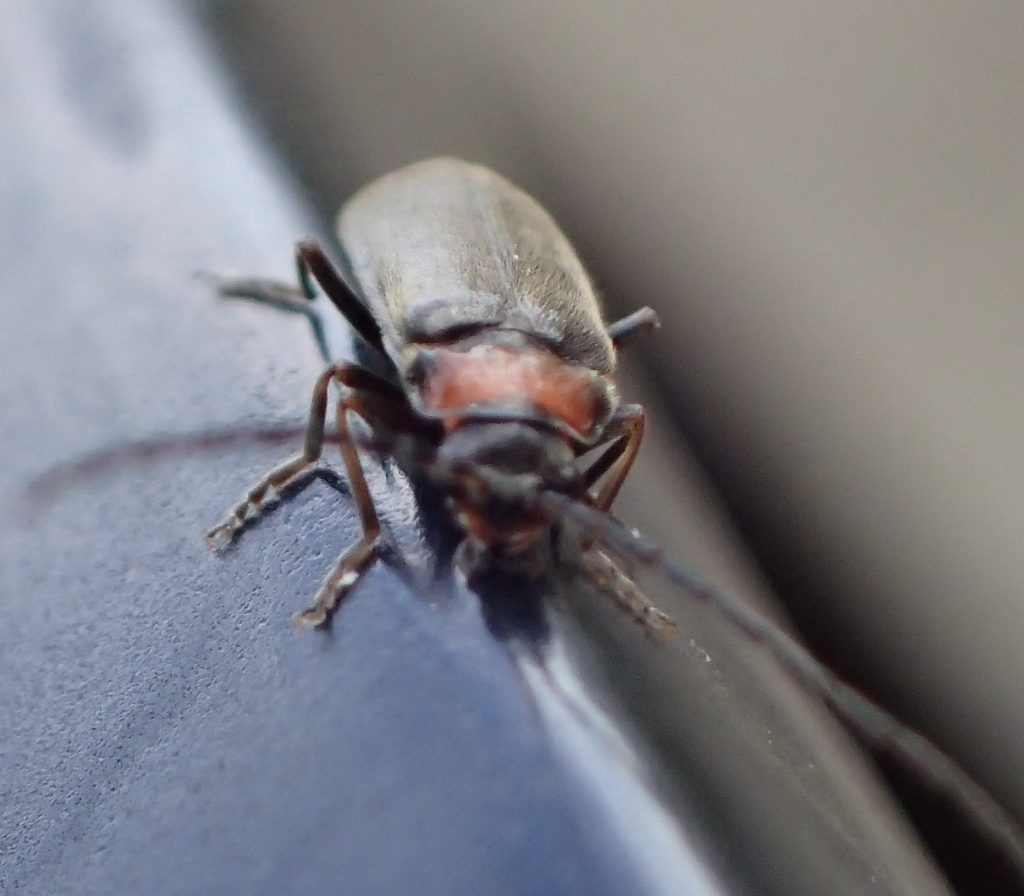
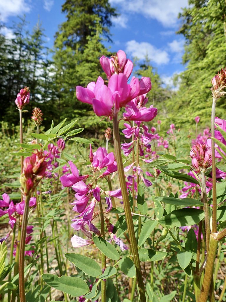
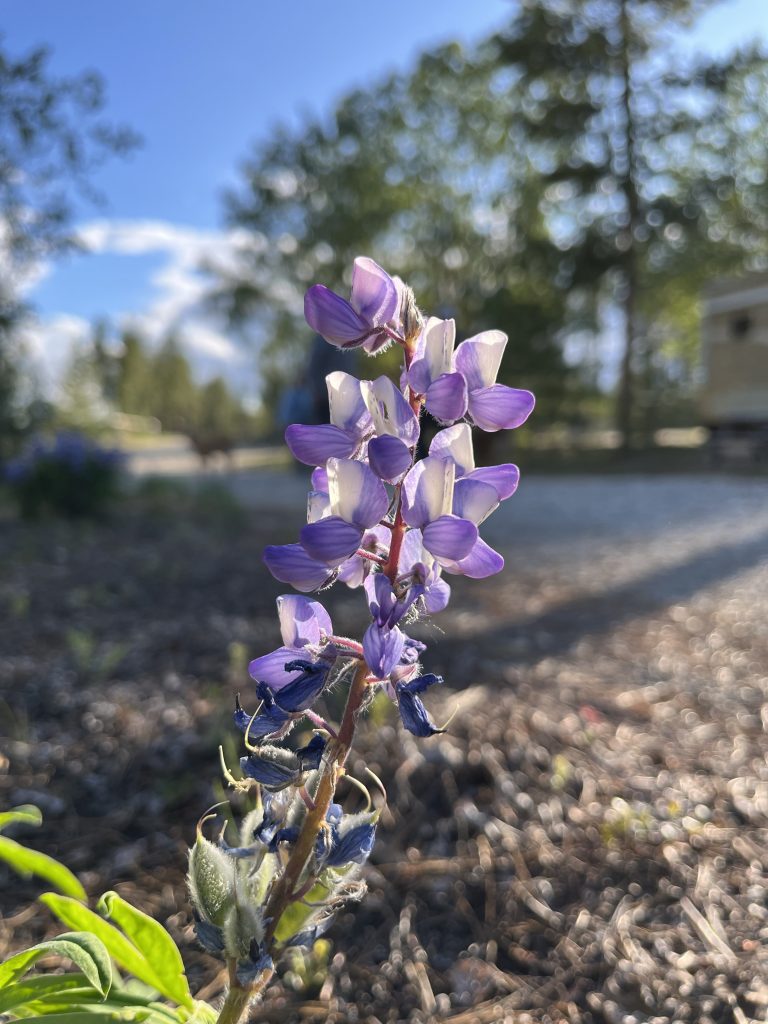
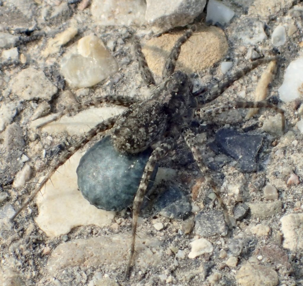
Some flora and fauna from this leg of the trip (mostly Hank’s macro photos):
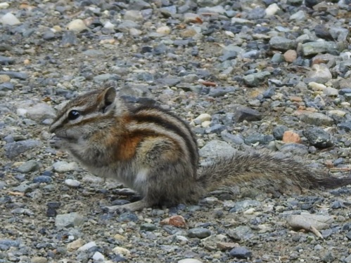
We have seen many chipmunks along the way.
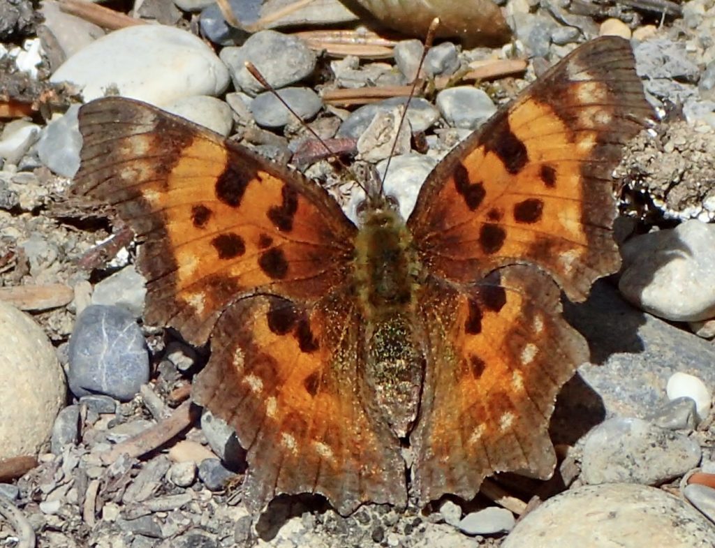
Possibly a satyr comma butterfly
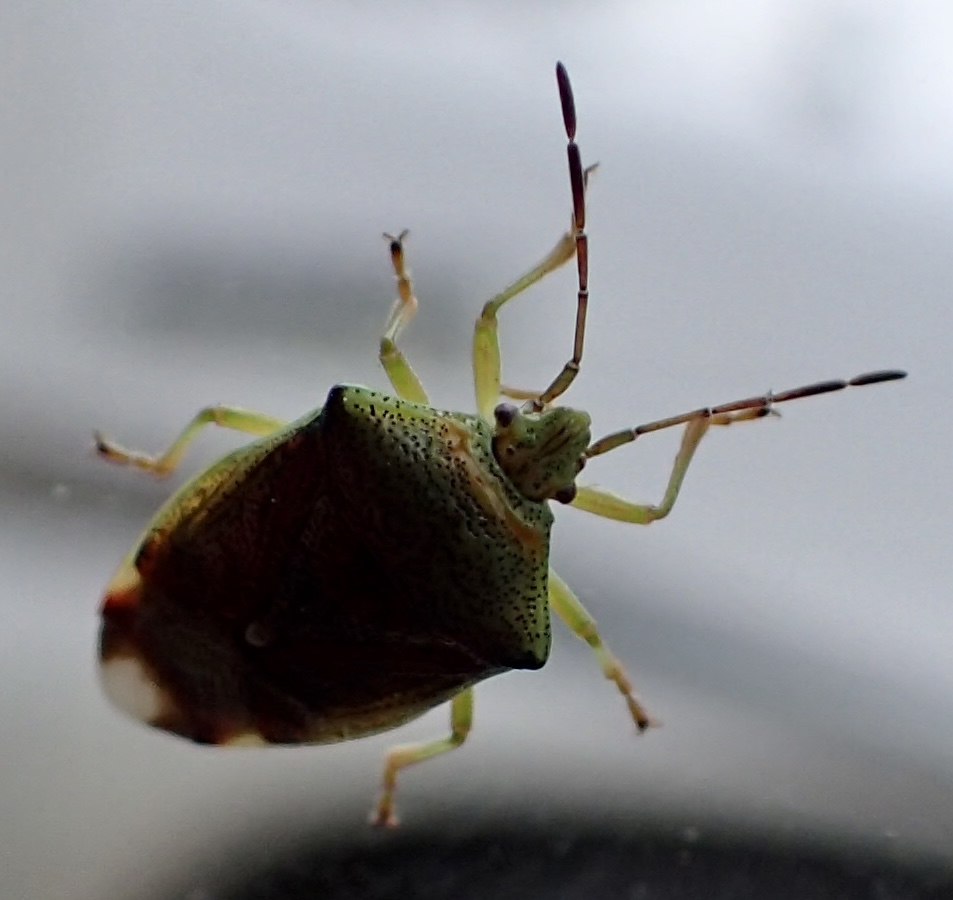
Top of shield bug
Soldier beetle
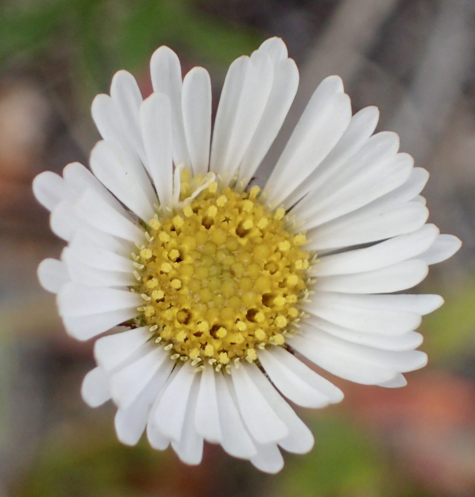
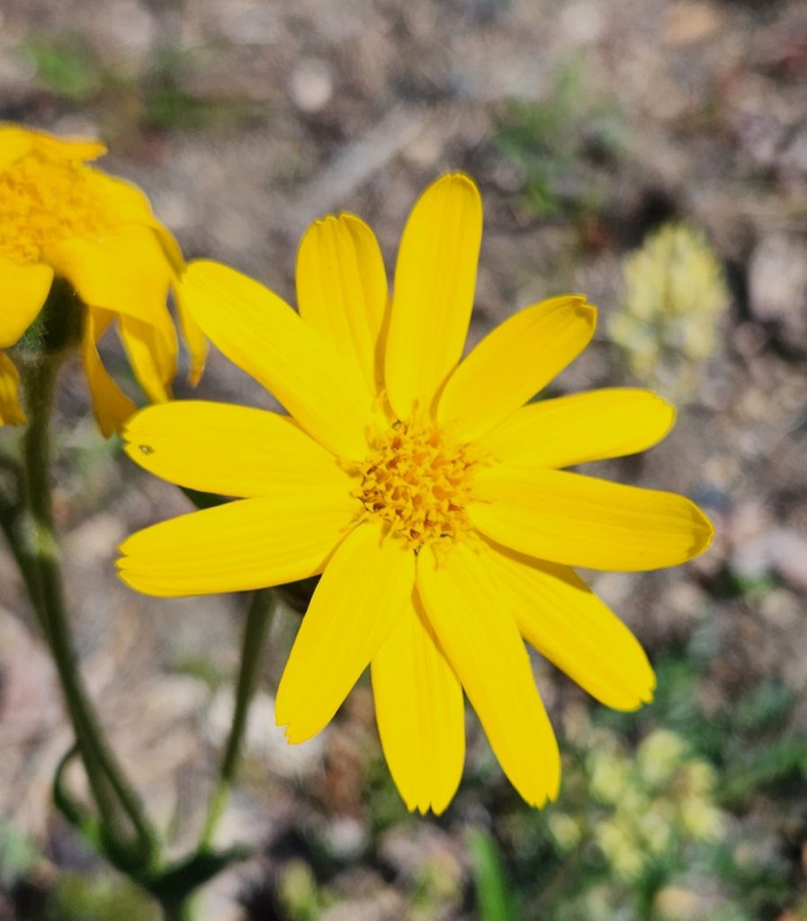
Fireweed (we think)
Bottom of shield bug
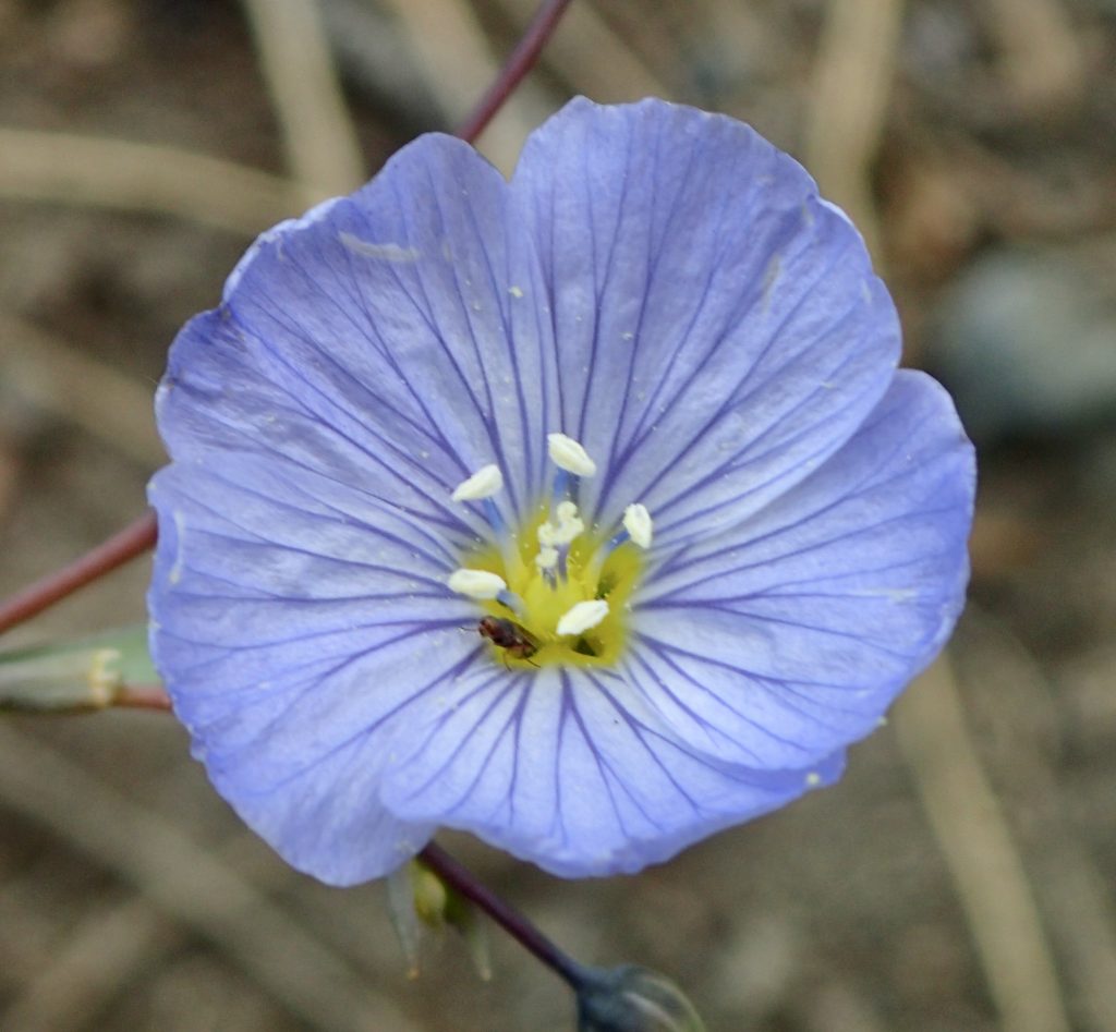
Arctic lupine
Wolf spider
9 thoughts on “Alaska-Part 3-Driving the Alaska Highway through BC and the Yukon”
fabulous country. Hard to imagine the size. Thank you for all of the detailing. What an incredible experience. Keep the photos coming. Such beauty.
Wow Cindy! Amazing trip with such detailed commentary. You should write a book about your travels! Steinbeck wrote, Travels with Charley, you could write, Travels with Hank( and Judy, Allyn, Tom, Luna, Blazer, Ron, and June). Enjoy!
Wow guys…this trip is getting better and better! We are so enjoying all of the details and photos and so appreciate you “taking us all along “ with you !!

fabulous country. Hard to imagine the size. Thank you for all of the detailing. What an incredible experience. Keep the photos coming. Such beauty.
AMAZING. All of it!!!!
Wow! Absolutely breathtaking! What an amazing trip. Thanks for all the pictures and updates on your adventures ❤️
Wow Cindy! Amazing trip with such detailed commentary. You should write a book about your travels! Steinbeck wrote, Travels with Charley, you could write, Travels with Hank( and Judy, Allyn, Tom, Luna, Blazer, Ron, and June). Enjoy!
Allyn says she should name the book, mosquitoes of wrath! Ha, ha!
Wow guys…this trip is getting better and better! We are so enjoying all of the details and photos and so appreciate you “taking us all along “ with you !!
Sending our love….
Marleen and Q
I set this aside to read when I had time to sit down and enjoy it. Thank you for taking us along on your trip!
Trip of a lifetime!
Im enjoying all the commentary and beautiful photographs.
Thanks so much.
Adrienne